
| East Peckham |
| East or Great Peckham, written in Domesday, PECHEHAM, and in the Textus Roffensis, PECHAM. It has the appellation of East Peckham from its situation eastward from West or Little Peckham, and of Great, from its large extent in comparison of that parish. They both had their name of Peckham probably from their situation; peat signifying in Saxon the peke or summit of an hill, and ham, a village or dwelling-. place. This parish is situated within the district of the Weald, in a country, which though for the most part too deep and miry to be pleasant, is yet exceedingly fertile as to its products, in corn, hops, and cattle, and is full of fine oak timber, with the trees of which it abounds. It joins northward up to Mereworth, and Lord Despencer's park, whence it descends southward for upwards of two miles to Brandt, formerly called Stidal's bridge, and Sladis bridge, and the river Medway, which flows along the southern boundaries of it, besides which it is watered by a small stream, which rises near Yokes, in West Peckham, and runs through this parish into the river. The high road from Maidstone through Mereworth, towards Hadlow and Tunbridge, runs along the western boundary of this parish, as that from Watringbury through Nettlested to Brandt bridge, and across the Medway towards Cranbrook, does along the eastern boundary of it. In that part of this parish next to Mereworth, is the village and church of East Peckham, and on the rise of a hill the antient and respectable looking mansion of Roydon-hall, the grounds of which are bounded on each side by coppice woods; hence the ground descends to a more wet and deeper country, being a stiff clayey soil, mostly grazing land, exceedingly rich and fertile, on which are bred and fatted some of the largest beasts of any in these parts. On the roads leading to Brandt-bridge in this part of East Peckham are several hamlets, as those of Chitley-cross, North-hatch, Hale-street, and others. extract from Hasted's History of Kent published in 1798 |
| Parish & other records | Before 1500 |
1500 to 1550 |
1550 to 1600 |
1600 to 1650 |
1650 to 1700 |
1700 to 1725 |
1725 to 1750 |
1750 to 1775 |
1775 to 1800 |
1800 to 1825 |
1825 to 1850 |
1850 to 1875 |
1875 to 1900 |
1900 to 1925 |
1925 to 1950 |
1950 to 1975 |
1975 to 2000 |
After 2000 |
||
| 721 | Births | 20 | 39 | 5 | 2 | 8 | 21 | 95 | 226 | 248 | 54 | 3 | ||||||||
| 130 | Christenings | 20 | 41 | 5 | 2 | 7 | 14 | 17 | 23 | 1 | ||||||||||
| 46 | Marriages | 8 | 8 | 8 | 1 | 2 | 2 | 6 | 6 | 1 | 4 | |||||||||
| 61 | Deaths | 15 | 23 | 11 | 1 | 1 | 2 | 5 | 2 | 1 | ||||||||||
| 63 | Burials | 15 | 24 | 12 | 1 | 1 | 4 | 3 | 3 | |||||||||||
| Books and other documents | |
| Published | Title, author and references |
| 1766 | The History of Tunbridge Wells by Thomas Benge Burr ⇒ p. 237 |
| 1798 | The History and Topographical Survey of the County of Kent - Volume V by Edward Hasted ⇒ p. 91 |
| 1814 | An Historical, Topographical and Descriptive Account of the Weald of Kent by T. D. W. Dearn ⇒ p. 182 |
| 1839 | Directory of Kent, Surrey & Sussex ⇒ entry |
| 1871 | A History of The Weald of Kent with an outline of the Early History of the County, Volume I. by Robert Furley, F.S.A. ⇒ Domesday p. 147; p. 226; peculiar of Canterbury p. 400 |
| 1874 | A History of The Weald of Kent with an outline of the History of the County to the present time, Volume II by Robert Furley, F.S.A. ⇒ p. 14; p. 108 |
| 1882 | Kelly's Directory of Kent by E. R. Kelly, M.A., F.S.S. ⇒ entry |
| 1914 | Highways and Byways in Kent by Walter Jerrold with Illustrations by Hugh Thomson ⇒ p. 322; p. 323 |
| Pictures | |||||||
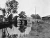 Branbridges - 1905 |  Hale Street - 1908 |  The Church - 1920 |  Freehold - 1920 | ||||
| Places and properties in East Peckham - a directory of homes, farms, churches, schools, inns, and other places of interest that existed prior to 1900 has been compiled from Post Office directories, Kelly's directories, Trade directories, Census data, Ordnance survey maps and books of the period |
|
|
|
|
The Weald is at Database version 14.05 which has ongoing updates to the 395,000 people; 9,000 places; 613 maps; 3,308 pictures, engravings and photographs; and 248 books loaded in the previous version


