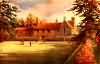
| Ightham |
| Ightham, so corruptly called for Eightham, which name it had from the eight boroughs or hams lying within the bounds of it, viz. Eightham, Redwell, Ivyhatch, Borough green, St. Cleres, the Moat, Beaulies, and Oldborough. In the Textus Roffensis it is spelt EHTEHAM. The Parish of Ightham for the most part is in the vale between the chalk and the sand or quarry hills, tho' it reaches above the former northward. Near the chalk hill, and for some diftance southward the same soil prevails, thence it is an unfertile deep land, and at the boundaries towards Shipborne a deep clay and heavy tillage land; from hence, and its situation, however healthy it may be, it is by no means a pleasant or a profitable one. The parish is very narrow, little more than a mile in width, but from north to south it extends near five miles, from Kingsdown, above the hills, to Shipborne, its southern boundary. At the foot of the chalk hill and north-west boundary of this parish, is the mansion of St. Clere, and not far from it Yaldham; about a mile from which is Ightham-court, and at a little distance further fouthward is the church and village, situated on the high road from Maidstone to Sevenoke and Westerham, which here crosses this parish by the hamlet of Borough-green, and the manor of Oldborough, or Oldbery, as it is now called, with the hill of that name, belonging to Richard James, esq. of this parish, in this part, and by Ivy-hatch plain, there is much rough uninclosed waste ground, the soil a dreary barren sand, consisting in this and the adjoining parish, of several hundred acres, being in general covered with heath and furze, with some scrubby wood interspersed among them. At the southern extremity of the parish, next to Shipborne, and adjoining to the grounds of Fairlawn, is the seat of the Moat, lowly situated in a deep and miry soil. A fair is kept yearly in this parish, upon the Wednesday in Whitsun week, which is vulgarly called Coxcombe fair. The Roman military way seems to have crossed this parish from Ofham, and Camps directing its course westward through it. The names of Oldborough, now called Oldberry-hill, and Stone-street in it, are certain marks of its note in former times. At Oldberry-hill there are the remains of a very considerable intrenchment, which is without doubt of Roman origin. It is situated on the top of the hill, and is now great part of it so overgrown with wood as to make it very difficult to trace the lines of it. It is of an oval form, and by a very accurate measurement, contains within its bounds the space of one hundred and thirty-feven acres. Just on the brow of the hill is an entrance into a cave, which has been long filled up by the sinking of the earth, so as to admit a passage but a very small way into it, but by antient tradition, it went much further in, under the hill. extract from Hasted's History of Kent published in 1798 |
| Parish & other records | Before 1500 |
1500 to 1550 |
1550 to 1600 |
1600 to 1650 |
1650 to 1700 |
1700 to 1725 |
1725 to 1750 |
1750 to 1775 |
1775 to 1800 |
1800 to 1825 |
1825 to 1850 |
1850 to 1875 |
1875 to 1900 |
1900 to 1925 |
1925 to 1950 |
1950 to 1975 |
1975 to 2000 |
After 2000 |
||
| 166 | Births | 1 | 2 | 2 | 9 | 29 | 58 | 54 | 9 | 2 | ||||||||||
| 40 | Christenings | 2 | 2 | 8 | 11 | 10 | 7 | |||||||||||||
| 24 | Marriages | 1 | 1 | 3 | 2 | 4 | 7 | 2 | 2 | 2 | ||||||||||
| 0 | Deaths | |||||||||||||||||||
| 0 | Burials | |||||||||||||||||||
| Books and other documents | |
| Published | Title, author and references |
| 1798 | The History and Topographical Survey of the County of Kent - Volume V by Edward Hasted ⇒ p. 33 |
| 1839 | Directory of Kent, Surrey & Sussex ⇒ entry |
| 1840 | New Guide for Tunbridge Wells by John Colbran and edited by James Phippen ⇒ p. 341 |
| 1874 | A History of The Weald of Kent with an outline of the History of the County to the present time, Volume II by Robert Furley, F.S.A. ⇒ p. 801 |
| 1882 | Kelly's Directory of Kent by E. R. Kelly, M.A., F.S.S. ⇒ entry |
| 1883 | Pelton's Illustrated Guide to Tunbridge Wells by J. Radford Thomson, M.A. ⇒ p. 170 |
| 1900 | Ightham Mote House and Church by J. Oldrid Scott ⇒ p. 189 |
| 1900 | Note on former owners of Ightham Mote House by Rev. C.E. Woodruff, M.A. ⇒ p. 195 |
| 1909 | English Homes and Villages (Kent & Sussex) also published as Tunbridge Wells and its Neighbourhood by Lady Hope ⇒ p. 242 |
| 1914 | Highways and Byways in Kent by Walter Jerrold with Illustrations by Hugh Thomson ⇒ p. 360 |
| 1933 | Country Houses of Kent by Arthur Oswald ⇒ p. 15 |
| Places and properties in Ightham - a directory of homes, farms, churches, schools, inns, and other places of interest that existed prior to 1900 has been compiled from Post Office directories, Kelly's directories, Trade directories, Census data, Ordnance survey maps and books of the period |
|
|
|
|
The Weald is at Database version 14.05 which has ongoing updates to the 395,000 people; 9,000 places; 613 maps; 3,308 pictures, engravings and photographs; and 248 books loaded in the previous version