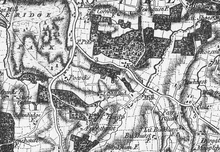
| Eridge Park, Sussex - c 1795 |
| Part of the 1 inch to 1 mile map of Sussex produced in 1795 by William Gardner (Chief Surveying Draftsman to the Board of Ordnance) and Thomas Gream (Surveyor to the Board of Ordnance). The map was dedicated to the 3rd Duke of Richmond as Lord Lieutenant of Sussex, was engraved by Thomas Foot and published by William Fadden, Charing Cross, London The map was partly based on the previously uncompleted survey and map of Sussex conducted by Thomas Yeakell and William Gardener in 1778 for more information refer to Printed Maps of Sussex, 1575-1900 by D. Kingsley, published by the Sussex Record Society The width of the image below is approximately 3 miles |
|
Size control: Medium ►►► Zoom control: Year control: |
|
The Weald is at Database version 14.05 which has ongoing updates to the 395,000 people; 9,000 places; 613 maps; 3,308 pictures, engravings and photographs; and 248 books loaded in the previous version