
| Historical notes about Rotherfield |
| 792 | History | RIDREFELD | Horsfield's Sussex | ||
| RIDREFELD was in old time the estate and dwelling-place of one Duke of Bertoald, who, as he sets forth the case in his charter of donation of it to the Abbey of St Denis, near Paris, "for the just demerit of his sins falling with a grevious sickness, and finding no manner of relief from all the application of physicins, but hearing that in France, at the Monastry of the Holy Martyrs, Dionysius Rusticus and Elentherius, where the veverable Folerade was the Abbot, many wonderful cures were wrought by these Saints," he, therefore , procures a passport from the Emperor Charles, and coming there, had lain but a very few days in his sick and weak condition before their shrine, when, by the mercy of God, and through the intercession of these martyrs, he found himself restored, perfectly sound and well. His gratitude, therefore, moved him to vow a vow to God and to these Saints; and having obtained some of their holy relics to carry back with him for his safeguard and protection, he returned home, where he built a church, and dedicated it to their name, in his manor, in the village called Redrefelde, which had come to him by inheritance from his ancestors. | |||||
| 792 | History | Redrefelde | Horsfield's Sussex | ||
| Charter or Deed by the Duke of Bertoald, dated 792, and of the reign of King Offa 31. "Wherefore as it is right that those by whom I have been delivered from all infirmity of body, should share with me in my inheritance, I give, with the consent of my brother Eadbald, and of my faithful relatives, by their writing, all my vill, which is called Redrefelde, situated upon the river which is called Salfroda, in the district called Sussex, together withh all its appurtanences, lands, meadows, pastures, fields, woods, and waters, to the holy martyrs of God, Dionysius Rusticus and Elentherius, to be had and held by them in perpetuum, as I hitherto have possessed." | |||||
| 1086 | History | Rotherfield | Domesday Book | ||
| The Land of the King [William I] In Rotherfield Hundred King William holds Rotherfield in lordship, from the holding of the Bishop of Bayeux. Earl Godwin held it. Then and now it answered for 3 hides. Land for 26 ploughs. In lordship 4 ploughs. 14 villagers with 6 smallholders have 14 ploughs; 4 slaves; woodland at 80 pigs from pasturage; a park. Value before 1066 £16; later £14; now £12; however, it pays £30. extract from the Domesday Book 1 hide was equivalent to land for one family or 120 acres. 1 hide equals 4 virgates. | |||||
| 1086 | History | Rotherfield | Domesday Book | ||
| The Land of the Count of Mortain (Pevensey Rape) The Count holds 2 hides himself which Alfward and Wulfward held from King Edward as 2 manors. Land for 6 ploughs. Ansfrid holds 1 hide of this land from the Count; Humphrey 1 virgate; William 1 virgate and 1 furlong; an Englishman 1 virgate. In lordship 4 1/2 ploughs; 6 villagers and 8 smallholders with 6 ploughs. 1 slave; 1 mill at 30d. Value before 1066, 30s; now 73s. extract from the Domesday Book 1 hide was equivalent to land for one family or 120 acres. 1 hide equals 4 virgates. | |||||
| 1086 | History | Reredfelle | Horsfield's Sussex | ||
| The lordship of Rotherfield (which possesses the rights of free warren and free chase) is of very considerable extent, comprising the whole of the parish of Rotherfield and the greatest part of Frant; within which latter Eridge Castle, the seat of the Lord of the Manor, is situated. It also embraces the whole of the great forest of Waterdown, which Camden describes as one ot the three great forests of Sussex. There is no doubt but that there was a park and chase here before the Conquest. From Doomsday book it may be collected that Rotherfield (then called Reredfelle) was a royal demesne. It was of the fee of Odo, Bishop of Baieux, brother to the Conqueror. The Doomsday book states - "The Saxon Earl, Godwin, held it, and it was taxed for three hides. The land consisits of twenty-six carucates; in demesne, four carucates and fourteen villains, with six borderers, having fourteen ploughs. There are four servants, and wood sufficient to feed forty hogs. There is a park. In time of King Edward the Confessor it was worth £16, and afterwards £14, now £12, and nevertheless pays £30." | |||||
| c 1100 | History | Rotherfield | Eeles' Frant | ||
| After William II had granted the Lordship of Rotherfield to Richard de Clare, the latter was succeeded by his son Gilbert who thereupon "granted and willingly confirmed … to the Church of St Andrew the Apostle of Rocicestre and the monks serving God in that place, the Church of Rotherfeilde with the Chapel of Frant …" | |||||
| 1262 | History | Rotherfield | Pullein's Rotherfield | ||
The Inquisition Post Mortem in 1262 of Richard de Clare, Earl of Gloucester and Hertford describes the "Extent of the Manor of Retherfeld in the county of Sussex …..
| |||||
| 1289 to 1314 | History | Rotherfield | Horsfield's Sussex | ||
| In 18th Edward I [1289] the manor or lordship was granted to Gilbert de Clare, Earl of Gloucester, and his wife, and to their heirs of their bodies, with remainder to the heirs of the said Gilbert. In 24th Edward I [1295] Gilbert de Clare, Earl of Gloucester and Hereford, held this manor. In 25th Edward I [1296] Joan, the late wife of Gilbert de Clare, held this lordship, with the hundred of Rotherfield and free chase. In 8th Edward II [1314] on the death of Gilbert de Clare, an extent was made of the manor. | |||||
| 1296 | Subsidy/tax list | Rotherfield | Pullein's Rotherfield | ||
| The Rotherfield Subsidy (Tax list) of 1296 for the Villat' de Suthborgh [Township of the South tithing] in the Hundred de Retherfeld | |||||
| 1296 | Subsidy/tax list | Rotherfield | Pullein's Rotherfield | ||
| The Rotherfield Subsidy (Tax list) of 1296 for the Villat' de Northborgh [Township of the North tithing] in the Hundred de Retherfeld | |||||
| 19th May 1308 | History | Rotherfield | Pullein's Rotherfield | ||
The Inquisition Post Mortem dated 19th May 1308 of Joan, late wife of Gilbert de Clare, Earl of Gloucester and Hertford, and the King's daughter describes the "land and tenements" of the manor of Rutherfeld ….
| |||||
| 1327 | Subsidy/tax list | Rotherfield | Pullein's Rotherfield | ||
| The Rotherfield Subsidy (Tax list) of 1327 for the Villat de Suthborgh [Township of the South tithing] in Retherfeld | |||||
| 1327 | Subsidy/tax list | Rotherfield | Pullein's Rotherfield | ||
| The Rotherfield Subsidy (Tax list) of 1327 for the Villat' de Northborgh [Township of the North tithing] in Retherfeld | |||||
| 1332 | Subsidy/tax list | Rotherfield | Pullein's Rotherfield | ||
| The Rotherfield Subsidy (Tax list) of 1332 for the Villat de Suthborgh [Township of the South tithing] in Retherfeld | |||||
| 1332 | Subsidy/tax list | Rotherfield | Pullein's Rotherfield | ||
| The Rotherfield Subsidy (Tax list) of 1332 for the Villat' de Northborgh [Township of the North tithing] in Retherfeld | |||||
| 1336 to 1377 | History | Rotherfield | Horsfield's Sussex | ||
| In 9th Edward III [1336] the manor appears to have been in the king's hands, for a commission was then issued for the purpose of holding an inquisition to inquire as to the depredations committed in this his free warren and free chase of Rotherfield. In 11th Edward III [1338] King Edward III granted this lordship, with all its rights and appurtenances to Hugh Le Despencer. In 12th Edward III [1339] there was a grant made of a market and fair in Rotherfield to Hugh de Audley, junior. In 49th Edward III [1376] Edward de Despencer appears to have died siezed of this lordship, and In 1st Richard II [1377] it belonged to Thomas Le Despencer. | |||||
| 1337 | History | Rotherfield | Pullein's Rotherfield | ||
| The Patent Roll of 1337. "The King grants to Hugh le Dispencer his kingsman the Manor of Retherfeld in the county of Sussex in fee" | |||||
| 1344 | History | Hundred of Rotherfield | Eeles' Frant | ||
| This was the hunting park, for which the Hundred of Rotherfield had been famous for generations and which in 1344, was described as follows: A chace containing 600 acres of which the pasture is worth by the year 25s … a wood containing above 200 acres … within the said chace is a messuage called Erugge … | |||||
| c 1350 | History | Rotherfield | Pullein's Rotherfield | ||
| Chief Messuage of the Manor of Retherfeld There is a certain chief messuage enclosed in palings, containing in itself four acres in which are wooden buildings, viz., a chamber for the Steward covered with shingles, a large kitchen partly covered with shingles a Stable covered with thatch and a chamber above the same for unexpected guests, a gate with a decayed wooden chamber over it covered with thatch, a thatched ox stable, a shingled house for "le dayrye", a piggery covered with thatch, a large granary for corn for the Lord and for use in the guesthouse covered with thatch, a granary covered with shingles worth yearly beyond reprises 6s 8d, there is a garden adjoining the said messuage containing in itself 1 acre, 3 roods 11 perches, with herbage worth 12d yearly and the same is of this small value because there are rabbits beginning to burrow in that place, the fruit of the same is of no value because there are few trees that part of the same garden is let to John the chaplain, holding at the lord's will, paying 6d yearly, and he holds it to build upon Total value 8s 2d with John the Chaplain's rent | |||||
| c 1350 | Tenant list | Rotherfield | Pullein's Rotherfield | ||
| Free tenants list of the Manor of Retherfeld circa 1350 | |||||
| 1411 to 1450 | History | Rotherfield | Horsfield's Sussex | ||
| In 12th Henry IV [1411] the lordship was in the possession of Richard Beauchamp, Earl of Warwick and Lord Bergavenny, and he married Isabella, sister and heir to Richard, son and heir to Thomas, Lord Despencer, cousin and heir of of Edward Lord Despencer. In 2nd Henry V [1414] Richard Beauchamp, Lord Bergavenny held it. In 18th Henry VI [1440] Isabella, late Countess of Warwick, was in possession of the lordship. In 24th Henry VI [1446] Henry de Bello Campo (Beauchamp), Duke of Warwick, was the owner of it. In 1450, by the marriage of Edward Nevill with Elizabeth, the sole daughter and heiress of Richard Beauchamp, Lord Bergavenny, he had livery of all her lands and great possessions, and among those of this same lordship, which have descended to the present possessor of the title | |||||
| 1597 | 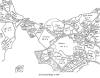 | Rotherfield surroundings | Rotherfield | Pullein's Rotherfield | |
| 1597 to 1598 | History | Rotherfield | Buckhurst Terrier | ||
| Sir John Sackville, who was sheriff of Surrey and Sussex in the reign of Henry VIII, married Margaret Boleyn, the aunt of Queen Anne Boleyn, so that his son Richard was that queen's first cousin. This Richard Sackville was a man of outstanding ability.......He grew very rich by dealings in land in many counties, often the former possessions of suppressed chantrys and of attainted noblemen, his name appears more frequently in the Close Rolls of that period than that of any other person ............ It was jestingly said of him that his name should be Fillsack, not Sackville. He acquired the lands of the Chantry of St. Marie in 1550, those of the Fraternity of St. Katherine probably at about the same time, Tablehurst in 1559, Imberhorne in 1560, and Alchorne in 1564............... The manor of Broome, which included the greater part of the village of Hartfield, was purchased some time after 1584. Collinghurst was also in his possession at the time of his death, April 21, 1564. His only son Thomas, born in 1536, was one of the most prominent men of his time. In his earlier years a poet, he was a favourite of Elizabeth I, his second cousin.... On the 8th of June, 1567, he was knighted, and on the same day created a baron under the title of Lord Buckhurst. Alter many services to the State he was made Lord High Treasurer in May, 1599. .......Soon after succeeding to the estates at the death of his father he set about the acquisition by purchase and exchange of further manors in the vicinity of Buckhurst......The manor of Withyham, called Mounkencourts or Munkloe 1569-70; the manors of Sheffield and Tarring Peverell 1570; Ridgehill 1576; Bolebrook 1590; Lavertie 1591; Framfield in 1592; Blackham 1592; Birchden, 1595; and Bullockstown in 1585.....Sir Thomas Sackville, Lord Buckhurst, had thus in 1597 in his possession seventeen manors in north-east Sussex, including the manor of Buckhurst, as well as several others in the southern part of the rape. In view of the many recent acquisitions, and the number of leases that had been granted since 1592, it was expedient to record the seventeen in a Terrier in 1597-8 | |||||
| 1610 | ![[North] Sussex](images/t/Speed1610E.jpg) | [North] Sussex by John Norden and augmented by John Speed | Rotherfeild | John Speed | |
| The first engraved maps of the counties of Great Britain were the work of Christopher Saxton who, under the authority of the Privy Council, surveyed the English counties in Elizabethan times, from 1574 to 1578. In 1593 he was followed by John Norden who projected an ambitious scheme for a complete series of county histories. He published before his death a number of counties - Middlesex, Hertfordshire, Essex, Northampton, Cornwall, Sussex and Surrey. John Speed's map of Sussex is based upon Norden's map and was engraved by Jodocus Hondius. It occupies pages nine and ten of John Speed's Atlas entitled "The Theatre of the Empire of Great Britaine", is 20 1/4 inches by 15 1/4 inches in size and shows additionally an interesting plan of Chichester and a spirited representation of the Battle of Hastings. | |||||
| 1645 | ![[North] Sussex](images/t/Blaeu1645E.jpg) | [North] Sussex by Jan Blaeu | Rotherfeild | Jan Blaeu | |
| 1695 | ![[North] Sussex](images/t/Morden1695E.jpg) | [North] Sussex by Robert Morden | Rotherfield | Robert Morden | |
| Robert Morden was a London bookseller from 1669 until his death in 1703. He specialised in the geographical field and was himself something of a cartographer and a publisher. Throughout the 17th and most of the 18th centuries, there was little distinction between the activity of book or print-selling and that of publishing: many booksellers were also printers or engravers. They undertook the sale of each others' work and often combined to meet the high cost of publishing a new map or reissue of an old atlas, even if the original plates were still available. This map was published in Brittania: a chorographical description of Great Britain and Ireland by William Camden. | |||||
| c 1724 | 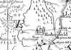 | Part of the 1 inch to 1 mile map of Sussex produced in 1724 by Richard Budgen | Rotherfield seat of Humphrey Fowle, Esq. | ||
| 1750 | 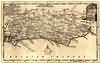 | Sussex by Thomas Kitchin | Rotherfield | Thomas Kitchin | |
| Thomas Kitchin, an engraver and publisher from c.1738 to 1776, held the appointment of Hydrographer to the King. His output was prolific. He engraved the maps of the British and French dominions in North America by John Mitchell (1755), which was used at the peace coucil at the end of the revolutionary war. In his later years he worked with his son (hence senior after his name in the c.1755 edition of the Small English Atlas). He died in 1784. | |||||
| 1756 | 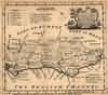 | Sussex by Emanuel Bowen | Rotherfield | Emanuel Bowen | |
| 1763 | ![A New Map of [North] Sussex](images/t/Kitchin1763E.jpg) | A New Map of [North] Sussex by Thomas Kitchin | Rotherfield | Thomas Kitchin | |
| Thomas Kitchin, an engraver and publisher from c.1738 to 1776, held the appointment of Hydrographer to the King. His output was prolific. He engraved the maps of the British and French dominions in North America by John Mitchell (1755), which was used at the peace coucil at the end of the revolutionary war. In his later years he worked with his son (hence senior after his name in the c.1755 edition of the Small English Atlas). He died in 1784. | |||||
| 1st Sep 1787 | ![[North] Sussex](images/t/Cary1787E.jpg) | [North] Sussex by John Cary | Rotherfield | John Cary | |
| John Cary, apprenticed to William Palmer in 1770, went into business in 1783 as a publisher of maps, plans and road-books. He was highly successful and is referred to as the founder of the modern English School of Cartography by H.G. Fordham | |||||
| c 1795 | 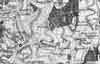 | Part of the 1 inch to 1 mile map of Sussex produced in 1795 by William Gardner and Thomas Gream | Rotherfield | ||
| 1808 | ![[North] Sussex](images/t/Cole1808E.jpg) | [North] Sussex by G.Cole and engraved by J.Roper | Rotherfield | G. Cole | |
| The British atlas; comprising a series of county maps…intended to illustrate and accompany 'The beauties of England and Wales' published 1808. | |||||
| c 1825 |  | Part of the 1 inch to 1 mile map of Sussex produced in 1825 by Christopher and John Greenwood | Rotherfield | ||
| 1834 | History | Rotherfield | Horsfield's Sussex | ||
| ROTHERFIELD - This extensive parish, occupying generally a very elevated district, is in many parts extremely barren. The iron-sand generally prevails, but some parts produce good wheat, oats and beans. It is surrounded by Frant, Wadhurst, Mayfield, Uckfield and Withyham. The village is about three miles from Mayfield, seven from Tunbridge Wells, sisteen from Lewes, and forty-two from London. A road passes through the village from Butcher Cross to Tunbridge Wells; and another from Crowborough to Wadhurst. It contains 14,710 acres; and in 1831 had a population of 3,085 | |||||
| 1840 | ![[North] Sussex](images/t/Dugdale1840E.jpg) | [North] Sussex by Joshua Archer, Pentonville, London | Rotherfield | Dugdale | |
| Dugdale's England and Wales Delineated | |||||
| 6th Jun 1841 | Census | Rotherfield | 1841 Census Rotherfield, Sussex | ||
| That part of the Parish of Rotherfield which lies South East of the road that leads from the Village of Rotherfield to Butchers Cross as far as the boundary of the parish, then keeping the boundary of the parish to Mark Cross and from thence by the high road to the Kings Arms Inn, Rotherfield. Enumerator - John E Tompsett | |||||
| 6th Jun 1841 | Census | Rotherfield | 1841 Census Rotherfield, Sussex | ||
| From the Kings Arms Inn, Rotherfield, to Mark Cross, and from thence by the boundary of the parish to the Cottages at the corner of Nap Wood on the Frant Road, and from thence to the Gravel Pit on Saxonbury Hill, taking the road past Green Hedges to Sprats Bottom, then to the Stream to Cowford Bridge, keeping the road back to the Kings Arms. Enumerator - C Wickens | |||||
| 6th Jun 1841 | Census | Rotherfield | 1841 Census Rotherfield, Sussex | ||
| From the Boars Head Inn by the Turnpike Road leading to Tunbridge Wells to the Crown Corner then taking the boundary of the Parish on the East to the two cottages at the corner of Nap Wood, and from thence to Gravel Pit on Saxonbury Hill, taking the road past Green Hedges to Sprats Bottom, then by the Stream to Cowford Bridge, keeping up the road about eight roods then turn in the gate at the bottom of Hornshurst Wood past Turks taking the house, then over Johnsons Bridge along the bottom of Lime Kiln Forest taking Testers and Browns houses and come out at the Boars Head Inn. Enumerator - William Wickenden | |||||
| 6th Jun 1841 | Census | Rotherfield | 1841 Census Rotherfield, Sussex | ||
| From Henry Pains by Water Hill to Walter's Brick Kiln up the road to the Gravel Pit on Gravel Pit Hill leaving Cains at Gravel Hill Farm to the left taking all on the South and South West, then take the road leading to Butcher's Cross as far as the boundary of the Parish keeping the boundary to the South round to Brick Barn Hill and from thence to Ford Brook and Sand Hill to Jarvis Brook and Henry Pains. Enumerator - George Allcorn | |||||
| 6th Jun 1841 | Census | Rotherfield | 1841 Census Rotherfield, Sussex | ||
| From Henry Pains to Maynards Gate then by the stream to Johnsons Bridge, from thence taking the road to the gate at the bottom of Hornhurst Wood about 8 roods above Cowford Bridge, leaving out the house on the road called Turks, then along the road through the Village of Rotherfield to Gravel Hill taking all on the West of the main road, then by Walter's Brick Kiln and Water Hill to Henry Pains. Enumerator - Ezra Maplesden | |||||
| 1851 | Directory | Rotherfield | Post Office Directory | ||
| ROTHERFIELD is a parish in Uckfield Union, 7 miles south-east from Tunbridge Wells, and 42 from London, giving name to a Hundred in Pevensey rape. Its area is 14,710 acres, and its population, in 1841, 3,054. It is assessed to the Income Tax at £9,224. .......... | |||||
| 30th Mar 1851 | Census | Rotherfield | 1851 Census Rotherfield, Sussex | ||
| That part of the Parish of Rotherfield which lies South East of the road that leads from the Village of Rotherfield to Butchers Cross as far as the boundary of the parish, then keeping the boundary of the parish to Mark Cross and from thence by the high road to the Kings Arms Inn, Rotherfield. Enumerator - Samuel Wickens | |||||
| 30th Mar 1851 | Census | Rotherfield | 1851 Census Rotherfield, Sussex | ||
| From the Kings Arms Inn, Rotherfield, to Mark Cross, and from Thence by the boundary of the parish to the Cottages at the corner of High Wood on the Frant Road, and from thence to the Gravel Pit on Saxonbury Hill, taking the road past Green Hedges to Sprats Bottom, then to the Stream to Cowford Bridge, keeping the road back to the Kings Arms. Enumerator - Thomas Crittall | |||||
| 30th Mar 1851 | Census | Rotherfield | 1851 Census Rotherfield, Sussex | ||
| From the Boars Head Inn by the Turnpike Road leading to Tunbridge Wells to the Crown Corner then taking the boundary of the Parish on the East to the two cottages at the corner of Nap Wood, and from thence to Gravel Pit on Saxonbury Hill, taking the road past Green Hedges to Sprats Bottom, then by the Stream to Cowford Bridge, keeping up the road about eight roods then turn in the gate at the bottom of Hornshurst Wood past Turks taking the house, then over Johnsons Bridge along the bottom of Lime Kiln Forest taking Testers and Browns houses and come out at the Boars Head Inn. Enumerator - William Wickenden | |||||
| 30th Mar 1851 | Census | Rotherfield | 1851 Census Rotherfield, Sussex | ||
| From Henry Pains by Water Hill to Walter's Brick Kiln up the road to the Gravel Pit on Gravel Hill leaving Cains at Gravel Pit Farm to the left taking all on the South and South West, then take the road leading to Butcher's Cross as far as the boundary of the Parish keeping the boundary to the South round to Brick Barn Hill and from thence to Ford Brook and Sand Hill to Jarvis Brook and Henry Pains. Enumerator - John Guest | |||||
| 30th Mar 1851 | Census | Rotherfield | 1851 Census Rotherfield, Sussex | ||
| From Henry Pains to Maynards Gate then by the stream to Johnsons Bridge, from thence taking the road to the gate at the bottom of Hornhurst Wood about 8 roods above Cowford Bridge, leaving out the house on the road called Turks, then along the road through the Village of Rotherfield to Gravel Hill taking all on the West of the main road, then by Walter's Brick Kiln to Water Hill and Henry Pains. Enumerator - William Leonard | |||||
| 1864 | 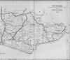 | East Sussex with the addition of the Railways by Mark Antony Lower | Rotherfield | Lower's Sussex | |
| Mark Antony Lower, son of Richard Lower, born 14th July 1813 in Heathfield, school master in the early 1830s at East Hoathly, Heathfield and Alfriston; and at Lewes from 1835 to 1867; and at Seaford 1867-1871. He then moved to London where he died in 1876. He was a founder member of the Sussex Archeological Society and a prolific contributor to the collections of the society. He published
| |||||
| 1867 | Directory | Rotherfield | Post Office Directory | ||
| ROTHERFIELD is a large parish, giving name to a hundred, in the Eastern division of the county, Uckfield union, diocese of Chichester, archdeaconry of Lewes, Tunbridge Wells county court district and Pevensey rape, 7 miles south from Tunbridge Wells, 4 west from Wadhurst station, and 30 from London. ............... The area is 14,733 acres, and the population in 1861 was 3,413. The charities are £28 per annum. ................. | |||||
| 1874 | Directory | Rotherfield | Post Office Directory | ||
| ROTHERFIELD is a large parish, giving name to a hundred, in the Eastern division of the county, Uckfield union, Tunbridge Wells county court district, Pevensey rape, archdeaconry of' Lewes, and diocese of Chichester, 7 miles south from Tunbridge Wells, and has a station on a branch of the London, Brighton and South Coast Railway, 47 from London. .............. The area is 14,733 acres; gross estimated rental, .£13,767; rateable value, £11,267; and the population in 1871 was 4,149. ................. | |||||
| c 1875 | 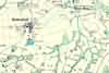 | Part of the 6 inch to 1 mile map of Sussex produced in 1875 by Ordnance Survey | Rotherfield | ||
| 3rd Apr 1881 | Census | Rotherfield | 1881 Census Rotherfield, Sussex | ||
| South East of Rotherfield including Argos Hill, Rotherhurst, Horse Grove, Kings Arms Public House, Cats Cottages, Holy Trinity Girls Orphanage, Marlborough Head and Frenches | |||||
| 3rd Apr 1881 | Census | Rotherfield | 1881 Census Rotherfield, Sussex | ||
| North East of Rotherfield including Catts, Mark Cross, Saxonbury Hill, Town Row Green, Spout Farm, Rotherfield Village and Town Row | |||||
| 3rd Apr 1881 | Census | Rotherfield | 1881 Census Rotherfield, Sussex | ||
| North West of Rotherfield including the Boars Head Public House, Hamsell Farm, Dane Gate, Redgate Mill and Spratts Bottom | |||||
| 1882 | Directory | Rotherfield | Kelly's Directory | ||
| ROTHERFIELD is a village and parish giving its name to a hundred, in the Eastern division of the county, Uckfield union, Tunbridge Wells county court district., Pevensey rape, rural deanery of Pevensey fourth division, archdeaconry of Lewes and diocese of Chichester, 7 miles south from Tunbridge Wells, with a station at Town Row, half a mile from the village, on the Tunbridge Wells and Eastbourne railway and 47 miles from London. ............ The area is 14,733 acres; rateable value, £16,143; and the population in 1881 was 4.334. .............. | |||||
| 1886 | 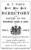 | W. T. Pike's 1885-1886 Blue Book and Directory | Pike's Blue Book | ||
| 1890 | History | Rotherfield | Firmin's Guide | ||
Rotherfield is about two-and-a-half miles from Crowborough. It is an ancient vill, and very interesting from its antiquity. The name was spelt in various ways - Reredfeld, Bedrefeld, Riderfeld, Ridrefelda, Ritherhamfeld, and by many of the villagers of the present day it is called Rudderful. It takes its name from the river Rither or Rother, which rises within the parish, in the cellar of the residence called Rotherhouse. Mr. Lower speaks of Rotherfield as perhaps the principal watershed in this part of England, for from a commanding spot it sends its waters to three rivers - the Rother, debouching at Rye, the Ouse, with outlet at Newhaven, and the Medway joining the Thames. Mr. Horsfield says: "The lordship of Rotherfield, which possesses the rights of free warren and free chase, is of considerable extent, compris-ing the whole of the parish of Rotherfield, and the greatest part of Frant. There is no doubt there was a park and chase here before the Conquest." It is mentioned in Domesday Book thus "King William holds in demesne Reredfeld of the fee of the Bishop of Bayeux. Earl Godwine held it, and then, as now, it vouched for three hides. There is land for 26 ploughs. In demesne are four ploughs, and 14 villeins with six bordars have 14 ploughs. There are four serfs, and wood for pannage for 80 hogs. There is a park." The women of Rotherfield were spoken of formerly as being taller than those of neighbouring places, and were supposed to possess an additional pair of ribs. It is singular that the palm of beauty was not claimed for them. At the present day it cannot be said that they enjoy any of these advantages over their neighbouring sisters, though they may favourably compare with them in all female excellences. | |||||
| 5th Apr 1891 | Census | Rotherfield | 1891 Census Rotherfield, Sussex | ||
| Being that part which lies South East of the Road leading from the Village of Rotherfield to Butchers Cross as far as the Boundary of the Parish then continuing the Boundary to Mark Cross and from thence by the High Road, the Kings Arms Inn in the Village taking all the houses within circle. Contents comprising Horse Grove, Cottage Hill, Rother House, Rugham, Argos Hill, Green Hill, Yew Trees, Frenches, Stile House, Marlboro's Head, Mark House, The Priest House at Holy Trinity Orphanage, Bletchingly, Bloomfield Villa and Beulah. The whole in the Parliamentary Division of Rye. | |||||
| 5th Apr 1891 | Census | Rotherfield | 1891 Census Rotherfield, Sussex | ||
| Being that part commencing at Mr Gower's Corner in the Village and keep the Road to Mark Cross and from thence to the boundary of the Parish at Knapps Wood on the Frant Road and from thence to the Gravel Pit on Saxonbury Hill taking the road to Greenhedges and Spratts bottom then take the Road to Cowford Bridge and Keeping the Main Road back to Mr Gower's Corner. Contents comprising Beddenden, Packhams Hill, Town Row, Sprout, Railway Station, Catts, Lodge Farm, Police Station, and the whole of Mark Cross, Saxonberry Hill, Frights, Tousers Lodge, The Forest, Stone House, Green House, Woodside, Town Row Green and Heathfields The whole in the Parliamentary Division of Rye. | |||||
| 5th Apr 1891 | Census | Rotherfield | 1891 Census Rotherfield, Sussex | ||
| Being that part commencing at the Boars Head Inn taking all the Houses on the Right of the Road leading to Tunbridge Wells by the Crown turning then keeping the boundary of the Parish to Knapp Wood then taking the Road to Crowberry Hill and Greenhedges to Spratts bottom and Cowford Bridge then turn to the right at the bottom of Hornshurst Wood to Turks over Solomons Bridge along the bottom of Lime Kiln Forest to the Boars Head Inn. Contents comprising The Rocks, Hamsell, Copyhold, Brownings, Danegate Farms, Hoaths, Blackthorn Hill, Redgate Mill, Newhouse, Turks, Testers and the Earls Cottages and Boars Head Inn The whole in the Parliamentary Division of Rye. | |||||
| 5th Apr 1891 | Census | Rotherfield | 1891 Census Rotherfield, Sussex | ||
| Being that part commencing at the Boars Head Inn taking the North West side of the Turnpike Road to the Crown turning and Boundary of the Parish to Orznash and then in a straight line to the Boarshead inn. Contents comprising Stonehouse, Renbys, Hamsell, Eridge Railway Station, Hamsell Hills, Fostal Cottages, Warren Rocks, Leelands, Hollambys, Pinstraws, Orznash, Motts, Bullfinch and Birchden The whole in the Parliamentary Division of Rye. | |||||
| 5th Apr 1891 | Census | Rotherfield | 1891 Census Rotherfield, Sussex | ||
| Being that part commencing at Johnsons Bridge taking the stream to Maynards Gate and Frogshole to the Beeches and Crowborough Cross then to Cooks Corner and Orznash to Boarshead Inn and Johnsons bridge. Contents comprising the Cottages at Pales Gate, Steel Cross House, Poundfield, Charity Farm, Hourne, Steel Cross, Boars Head, Crowboro Cross and Houses on the old Turnpike Road The whole in the Parliamentary Division of Rye. | |||||
| 5th Apr 1891 | Census | Rotherfield | 1891 Census Rotherfield, Sussex | ||
| Being that part commencing at Mr Brooker's Shop at Frogshole taking the Cottages to Jarvis Brook to the Crossways at Coldharbour keeping the North side of the Road to Crowboro Cross, then take the Road to the White Hart and Frogshole. Contents comprising the Railway Station, Hotel, Farningham Road, Towners Hill, Beeches, White Hart, Chapel Green, Roundabouts, Myrtle Road, Trenches Corner, Blacknest and Cock Mount Cottages The whole in the Parliamentary Division of Rye. | |||||
| 5th Apr 1891 | Census | Rotherfield | 1891 Census Rotherfield, Sussex | ||
| Being that part commencing at Coldharbour keeping the Road to the Sheeplain and Cookscorner, Crowboro Cross and Coldharbour. Contents comprising Beacon Hill, The Observatory, Red Cross Inn, Wind mill House, Mr Mackintosh's, Mr Dents, South View and Crowboro Common The whole in the Parliamentary Division of Rye. | |||||
| 5th Apr 1891 | Census | Rotherfield | 1891 Census Rotherfield, Sussex | ||
| Being that part commencing at Jarvis brook to Sand hill by Fordbrook to the Boundary of the Parish on Brick Barn Hill still keeping the Parish Boundary to the Sheepplain back to the Rose and Crown, Coldharbour and Jarvis Brook. Contents comprising Walshes, Burnt Oak, Brookhouse, Sweethaws, Slaugham Gill, Moses, Adams, Stone Cross, The Rocks, Highbroom, Redbridge and Fordbrook The whole in the Parliamentary Division of Rye. | |||||
| 5th Apr 1891 | Census | Rotherfield | 1891 Census Rotherfield, Sussex | ||
| 5th Apr 1891 | Census | Rotherfield | 1891 Census Rotherfield, Sussex | ||
| 5th Apr 1891 | Census | Rotherfield | 1891 Census Rotherfield, Sussex | ||
| c 1899 | 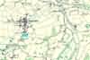 | Part of the 6 inch to 1 mile map of Sussex produced in 1899 by Ordnance Survey | Rotherfield | ||
| 13th Jun 1923 | History | Rotherfield | Pullein's Rotherfield | ||
| "No story of Rortherfield would be complete which failed to tell of the pageant that was enacted on June 13, 1923, on the historic ground of the Court Mead." See The Pageant | |||||
| 1928 | 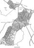 | Dewland Manor in 1675 by Catherine Pullein | Rotherfield | Pullein's Rotherfield | |
The Weald is at Database version 14.05 which has ongoing updates to the 395,000 people; 9,000 places; 613 maps; 3,308 pictures, engravings and photographs; and 248 books loaded in the previous version


