
| Historical notes about Waldron |
| 1086 | History | Waldron | Waldron by Rev. Ley | ||
| Domesday Book entry: In the Edluestone Hundred. "Ansfrid holds one hide of the Earl in Waldrene, which is assessed at such quantity. Aelveva held it of King Edward by allodial tenure. The arable is three plough lands and a half. There is one plough with a villain in the demesne. Twenty shillings have been the constant estimate." In the Havochesberie Hundred. "Aelveva, a free woman, held half a rood land in Waldene, exempt of Land tax. Here Osbern has a villain with five oxen. The value is two shillings." | |||||
| 1610 | ![[North] Sussex](images/t/Speed1610E.jpg) | [North] Sussex by John Norden and augmented by John Speed | Walderne | John Speed | |
| The first engraved maps of the counties of Great Britain were the work of Christopher Saxton who, under the authority of the Privy Council, surveyed the English counties in Elizabethan times, from 1574 to 1578. In 1593 he was followed by John Norden who projected an ambitious scheme for a complete series of county histories. He published before his death a number of counties - Middlesex, Hertfordshire, Essex, Northampton, Cornwall, Sussex and Surrey. John Speed's map of Sussex is based upon Norden's map and was engraved by Jodocus Hondius. It occupies pages nine and ten of John Speed's Atlas entitled "The Theatre of the Empire of Great Britaine", is 20 1/4 inches by 15 1/4 inches in size and shows additionally an interesting plan of Chichester and a spirited representation of the Battle of Hastings. | |||||
| 1645 | ![[North] Sussex](images/t/Blaeu1645E.jpg) | [North] Sussex by Jan Blaeu | Walderne | Jan Blaeu | |
| 1695 | ![[North] Sussex](images/t/Morden1695E.jpg) | [North] Sussex by Robert Morden | Waldern | Robert Morden | |
| Robert Morden was a London bookseller from 1669 until his death in 1703. He specialised in the geographical field and was himself something of a cartographer and a publisher. Throughout the 17th and most of the 18th centuries, there was little distinction between the activity of book or print-selling and that of publishing: many booksellers were also printers or engravers. They undertook the sale of each others' work and often combined to meet the high cost of publishing a new map or reissue of an old atlas, even if the original plates were still available. This map was published in Brittania: a chorographical description of Great Britain and Ireland by William Camden. | |||||
| c 1724 | 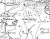 | Part of the 1 inch to 1 mile map of Sussex produced in 1724 by Richard Budgen | Waldron | ||
| 1750 | 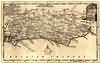 | Sussex by Thomas Kitchin | Waldron | Thomas Kitchin | |
| Thomas Kitchin, an engraver and publisher from c.1738 to 1776, held the appointment of Hydrographer to the King. His output was prolific. He engraved the maps of the British and French dominions in North America by John Mitchell (1755), which was used at the peace coucil at the end of the revolutionary war. In his later years he worked with his son (hence senior after his name in the c.1755 edition of the Small English Atlas). He died in 1784. | |||||
| 1756 | 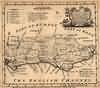 | Sussex by Emanuel Bowen | Waldron | Emanuel Bowen | |
| Emanuel Bowen was a map- and print- seller, engraver and publisher. Britannia Depicta published (1720 to 1759) was probably his first publication and he must have been gratified at its success. He continued in business until his death in 1767, and at one time help the appointments of engraver to both George II and Louis XV. Nevertheless he died in reduced circumstances. His son Thomas carried on the business until c. 1790 when he died in the Clerkswell workhouse. In 1756 Benjamin Martin published The Natural History of England which contained the Emanuel Bowen's map of Sussex. | |||||
| 1763 | ![A New Map of [North] Sussex](images/t/Kitchin1763E.jpg) | A New Map of [North] Sussex by Thomas Kitchin | Waldron | Thomas Kitchin | |
| Thomas Kitchin, an engraver and publisher from c.1738 to 1776, held the appointment of Hydrographer to the King. His output was prolific. He engraved the maps of the British and French dominions in North America by John Mitchell (1755), which was used at the peace coucil at the end of the revolutionary war. In his later years he worked with his son (hence senior after his name in the c.1755 edition of the Small English Atlas). He died in 1784. | |||||
| 1st Sep 1787 | ![[North] Sussex](images/t/Cary1787E.jpg) | [North] Sussex by John Cary | Waldron | John Cary | |
| John Cary, apprenticed to William Palmer in 1770, went into business in 1783 as a publisher of maps, plans and road-books. He was highly successful and is referred to as the founder of the modern English School of Cartography by H.G. Fordham | |||||
| c 1795 | 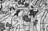 | Part of the 1 inch to 1 mile map of Sussex produced in 1795 by William Gardner and Thomas Gream | Waldron | ||
| 1808 | ![[North] Sussex](images/t/Cole1808E.jpg) | [North] Sussex by G.Cole and engraved by J.Roper | Waldron | G. Cole | |
| The British atlas; comprising a series of county maps…intended to illustrate and accompany 'The beauties of England and Wales' published 1808. | |||||
| c 1825 |  | Part of the 1 inch to 1 mile map of Sussex produced in 1825 by Christopher and John Greenwood | Waldron | ||
| 1837 | ![[North] Sussex](images/t/Moule1837E.jpg) | [North] Sussex by Thomas Moule | Waldron | Thomas Moule | |
| Thomas Moule was a bookseller. He published a number of important works on heraldry and antiquities, including Bibliotheca heraldica Brittaniae in 1822. The English Counties delineated; or, a topographical description of England has a complete series of county maps and was published by Thomas Moule in 1837 | |||||
| 1840 | ![[North] Sussex](images/t/Dugdale1840E.jpg) | [North] Sussex by Joshua Archer, Pentonville, London | Waldron | Dugdale | |
| Dugdale's England and Wales Delineated | |||||
| 6th Jun 1841 | Census | Waldron | 1841 Census Waldron, Sussex | ||
| Western Division - Commencing at Possingworth, comprising all that part of the parish West of the road leading to Horeham Gate including Waldron Street Enumerator - Thomas Hassell; Registrar - Henry Holman | |||||
| 6th Jun 1841 | Census | Waldron | 1841 Census Waldron, Sussex | ||
| Middle Division - Commencing at Rock Hill taking the road to Little London, thence to Cross in Hand and continuing to Warren Corner and terminating at Mr Gosling's cottage Enumerator - John Unstead; Registrar - Henry Holman | |||||
| 6th Jun 1841 | Census | Waldron | 1841 Census Waldron, Sussex | ||
| North Division - All that part of the parish from Sharps Corner to the Thorns, thence to New Pond, Cross in Hand Gate, Herrings and terminating at Jacob Hunts Enumerator - Peter Gosling; Registrar - Henry Holman | |||||
| 1851 | Directory | Waldron | Post Office Directory | ||
| WALDRON, a parish 7 miles from Uckfield, and 50 from London, in the Hundred of Shiplake, rape of Pevensey. ......... Waldron had 7,150 Acres, and a population of 1,065, in 1841, assessed to the Income Tax, in 1842, at £3,323. …….. | |||||
| 30th Mar 1851 | Census | Waldron | 1851 Census Waldron, Sussex | ||
| Framfield Parish. South District. All that part of the Parish that lies on the South side of the high road leading from Black Boys to Horeham as far as Hooks Farm including all the houses adjoining that road, likewise all those comprising the village of Waldron. Enumerator - Harry Hassell, Grocer, Waldron Village. | |||||
| 30th Mar 1851 | Census | Waldron | 1851 Census Waldron, Sussex | ||
| Framfield Parish. Middle district. Commencing at the Brook following the high road to Burnt Oak Green, Saunders Mill and to the stream on the Southern side of the Hamlet of Little London, from thence to the White House and to the houses situated on the South side of the New Pond, next taking the high road as far Cross in Hand toll gate, returning by Belle View, Waldron Down and following the high road to Siggs Farm and terminating at the Post Office. Enumerator - John Unstead, Wheelwright, Waldron Street | |||||
| 30th Mar 1851 | Census | Waldron | 1851 Census Waldron, Sussex | ||
| Framfield Parish. North District. Commencing at Waldron Corner and following the high road at Horeham Toll Gate and as far as Woodgate's Cottage, Horeham Flat, from thence to Little London, Waldron, Thorns, Herrings Farm and terminating at the Toll Gate Cross in Hand. Enumerator - Peter Gosling | |||||
| 1864 | 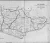 | East Sussex with the addition of the Railways by Mark Antony Lower | Waldron | Lower's Sussex | |
| Mark Antony Lower, son of Richard Lower, born 14th July 1813 in Heathfield, school master in the early 1830s at East Hoathly, Heathfield and Alfriston; and at Lewes from 1835 to 1867; and at Seaford 1867-1871. He then moved to London where he died in 1876. He was a founder member of the Sussex Archeological Society and a prolific contributor to the collections of the society. He published
| |||||
| 1867 | Directory | Waldron | Post Office Directory | ||
| WALDRON is a parish, 6 miles south-east from Uckfield, 8 north-west from Hailsham, 11 north-north-east from Lewes, and 50 from London, in the Eastern division of the county, Uckfield union, Shiplake and Dill hundreds, Lewes county court district, archdeaconry and rural deanery, rape of Pevensey, and diocese of Chichester. .............. The area is 6,218 acres, and the population in 1861 was 1,132. ................... | |||||
| 1874 | Directory | Waldron | Post Office Directory | ||
| WALDRON is a parish, 6 miles east-by-south from Uckfield, 8 north-west, from Hailsham, 11 north-north-east from Lewes, and 50 from London, in the Eastern division of the county, Uckfield union, Shiplake and Dill hundreds, rape of Pevensey, Lewes county court district, and in the archdeaconry and rural deanery of Lewes, and diocese of Chichester. ......... The area is 6,218 acres; gross estimated rental, £5,604; rateable value, £4,645; and the population in 1871 was 1,252. ............... | |||||
| 3rd Apr 1881 | Census | Waldron | 1881 Census Waldron, Sussex | ||
| Waldron Village and Possingworth | |||||
| 3rd Apr 1881 | Census | Waldron | 1881 Census Waldron, Sussex | ||
| Little London and Tilsmore | |||||
| 1882 | Directory | Waldron | Kelly's Directory | ||
| WALDRON is a village and parish 6 miles east-by-south from Uckfield, 8 north-west from Hailsham, 11 north-north-east from Lewes and 50 from London, in the Eastern division of the county, Uckfield union, Shiplake and Dill hundreds, rape of Pevensey, Lewes county court district and in the rural deanery of Dallington, archdeaconry of Lewes and diocese of Chichester. There are two stations in the parish, Heathfield and Horeham road on the L. B. & S. C. Railway. ............. The area is 6,218 acres ; rateable value, £6,479 ; and the population in 1881 was 1,342. .............. | |||||
The Weald is at Database version 14.05 which has ongoing updates to the 395,000 people; 9,000 places; 613 maps; 3,308 pictures, engravings and photographs; and 248 books loaded in the previous version


