
| Historical notes about Crowborough |
| Sep 1291 | Information | Crowbergh Hill | Sutton's Historical Notes | ||
| In the 13th century Gelderegg, it appears, was just within the limits of the parish of Buxted, but the boundary line has since been diverted, for Gilderedge is now in the adjoining parish of Withyham. .......... It appears that the inhabitants of Gelderegg were situated at such a distance from their parish church at Buxted that during the greater part of the winter season, owing to inundations and the dangerous character of the highway, they were unable to attend that church . .... necessity therefore compelled them to resort to the more accessible church of Withyham ....... led to petition Pope Nicholas IV that in order to prevent these irregularities on the part of the inhabitants of Gelderegg, a chapel having a chaplain of its own should be built within the parish of Buxted but adjacent to Gelderegg......... The Pope agreed to this, and a bull was accordingly sent to the Archbishop to that effect dated 4 Kal. Sept. 1291.......... the Archbishop granted to John de Lewes, rector of the church of Bocstede, two acres of land lying on the waste of Crowbergh Hill at a place commonly called Scherche juxta Gelderegg on which a new chapel was to be built and a cemetery provided........ no trace of a chapel has been discovered at Gelderegg, it is impossible to say whether it was ever built or not............ | |||||
| 1597 to 1598 | History | Crowborough | Buckhurst Terrier | ||
| Sir John Sackville, who was sheriff of Surrey and Sussex in the reign of Henry VIII, married Margaret Boleyn, the aunt of Queen Anne Boleyn, so that his son Richard was that queen's first cousin. This Richard Sackville was a man of outstanding ability.......He grew very rich by dealings in land in many counties, often the former possessions of suppressed chantrys and of attainted noblemen, his name appears more frequently in the Close Rolls of that period than that of any other person ............ It was jestingly said of him that his name should be Fillsack, not Sackville. He acquired the lands of the Chantry of St. Marie in 1550, those of the Fraternity of St. Katherine probably at about the same time, Tablehurst in 1559, Imberhorne in 1560, and Alchorne in 1564............... The manor of Broome, which included the greater part of the village of Hartfield, was purchased some time after 1584. Collinghurst was also in his possession at the time of his death, April 21, 1564. His only son Thomas, born in 1536, was one of the most prominent men of his time. In his earlier years a poet, he was a favourite of Elizabeth I, his second cousin.... On the 8th of June, 1567, he was knighted, and on the same day created a baron under the title of Lord Buckhurst. Alter many services to the State he was made Lord High Treasurer in May, 1599. .......Soon after succeeding to the estates at the death of his father he set about the acquisition by purchase and exchange of further manors in the vicinity of Buckhurst......The manor of Withyham, called Mounkencourts or Munkloe 1569-70; the manors of Sheffield and Tarring Peverell 1570; Ridgehill 1576; Bolebrook 1590; Lavertie 1591; Framfield in 1592; Blackham 1592; Birchden, 1595; and Bullockstown in 1585.....Sir Thomas Sackville, Lord Buckhurst, had thus in 1597 in his possession seventeen manors in north-east Sussex, including the manor of Buckhurst, as well as several others in the southern part of the rape. In view of the many recent acquisitions, and the number of leases that had been granted since 1592, it was expedient to record the seventeen in a Terrier in 1597-8 | |||||
| 1610 | ![[North] Sussex](images/t/Speed1610E.jpg) | [North] Sussex by John Norden and augmented by John Speed | Crowboro hill | John Speed | |
| The first engraved maps of the counties of Great Britain were the work of Christopher Saxton who, under the authority of the Privy Council, surveyed the English counties in Elizabethan times, from 1574 to 1578. In 1593 he was followed by John Norden who projected an ambitious scheme for a complete series of county histories. He published before his death a number of counties - Middlesex, Hertfordshire, Essex, Northampton, Cornwall, Sussex and Surrey. John Speed's map of Sussex is based upon Norden's map and was engraved by Jodocus Hondius. It occupies pages nine and ten of John Speed's Atlas entitled "The Theatre of the Empire of Great Britaine", is 20 1/4 inches by 15 1/4 inches in size and shows additionally an interesting plan of Chichester and a spirited representation of the Battle of Hastings. | |||||
| 1645 | ![[North] Sussex](images/t/Blaeu1645E.jpg) | [North] Sussex by Jan Blaeu | Crowboro hill | Jan Blaeu | |
| 1695 | ![[North] Sussex](images/t/Morden1695E.jpg) | [North] Sussex by Robert Morden | Crowborow hill | Robert Morden | |
| Robert Morden was a London bookseller from 1669 until his death in 1703. He specialised in the geographical field and was himself something of a cartographer and a publisher. Throughout the 17th and most of the 18th centuries, there was little distinction between the activity of book or print-selling and that of publishing: many booksellers were also printers or engravers. They undertook the sale of each others' work and often combined to meet the high cost of publishing a new map or reissue of an old atlas, even if the original plates were still available. This map was published in Brittania: a chorographical description of Great Britain and Ireland by William Camden. | |||||
| c 1724 | 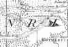 | Part of the 1 inch to 1 mile map of Sussex produced in 1724 by Richard Budgen | Crowborrow Beacon | ||
| 12th Jun 1734 | History | Crowborough | Sir Henry Fermor's Will | ||
| Extracts from Sir Henry Fermor's will dated 21 January 1732 and proven on 12th June 1734 I will and appoint William Oakill of Sevenoaks, aforesaid, Schoolmaster of the Charity School I have directed to be built in the Parish of Rotherfield ............... I will and direct that my trustees shall lay out any sum, not exceeding the sum of £1,500 in erecting and building a chapel, or church, and a Charity School, in the plainest and cheapest manner, so as it be strong and lasting, for the ease and benefit of the parishes and parishioners of Rotherfield and Buxted, in the said County of Sussex, which Church and Charity School I will shall be erected and built in or near a place called Crowborough and Ashdown Forest, as my executors shall think most convenient, for the use and benefit of the very ignorant and heathenish people A further £4,500 was given for purchase of land to be held in trust so that the rents and profits earned could go towards the maintenance of a shoolmaster and minister ....... A sum of £3,000 was to be invested in land for the benefit of the poor children to be taught and educated in the said school, from time to time, as long as they continue scholars there; the yearly rents, issues, and profits of the same land to be laid out in buying wool, hemp and books, to be equally divided and distributed amongst them ... ................... Sir Henry stipulated that no child should be less than 7 years of age upon admittance, nor proceed in education above the space of four years". The children were to be taught to read, write and cast accounts, and at no time were there to be more than 40 children in attendance. Sir Henry Fermor died in Sevenoaks on 2 June 1734 The Charity School and Chapel were completed in 1744 | |||||
| 1743 | Reflections | Crowborough | |||
Jeremiah Milles recounts a journey from London to Tunbridge Wells, Rye, Winchelsea, Hastings, Battle and Lewes. Begun August 20th, finished September 2nd, 1743 Jeremiah was born at Highclere, Hampshire in 1714, educated at Eton and Oxford. In 1741 he was elected a Fellow of the Society of Antiquaries and in the following year he became a Fellow of the Royal Society. The office of Precentor of Exeter Cathedral in 1747 was followed by that of Dean in 1762. Jeremiah Milles was at the time of his journeys through Sussex in August and September 1743 aged 29, unmarried, of independant means, with marked antiquarian interests and well travelled. At the end of his journey he leaves Lewes for Tunbridge Wells … "About eight miles from Lewes I passed through a small town called Uckfield, and a little beyond it on the right hand side Mr Medley is building a fine seat at a place called Buxted. About two mile further I came to a great heath which is part of Ashdown forest, and ascending very gently for near a mile came to the summit of the hill, where there was formerly a beacon: it is still called Crowburrow Beacon. From hence there is a most glorious prospect every way, eastward over the Weald of Sussex into Kent, southward as far as the sea, westward as far as Lewes and the downs about it, and northward of the forests of Ashdown and Waterdown and into Surrey. A gardener has built a house on the very summit of this bleak hill and has found means to raise hedges and to make a most beautiful little garden, though the whole does not enclose an acre of ground. It must be a delightful place in summer, but it is most excessively bleak and exposed to the wind. This is about 14 miles from Lewes and eight from Tunbridge Wells. Descending the hill I went in an enclosed country 'til I came within two miles of the Wells, when I came on the forest of Waterdown, which brought me late that night to Tunbridge Wells. These 22 miles from Lewes are very long and tedious, especially the first fourteen." | |||||
| 1st Sep 1787 | ![[North] Sussex](images/t/Cary1787E.jpg) | [North] Sussex by John Cary | Crowborough Beacon | John Cary | |
| John Cary, apprenticed to William Palmer in 1770, went into business in 1783 as a publisher of maps, plans and road-books. He was highly successful and is referred to as the founder of the modern English School of Cartography by H.G. Fordham | |||||
| c 1795 | 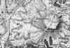 | Part of the 1 inch to 1 mile map of Sussex produced in 1795 by William Gardner and Thomas Gream | Crowborough | ||
| 1808 | ![[North] Sussex](images/t/Cole1808E.jpg) | [North] Sussex by G.Cole and engraved by J.Roper | Crowborough | G. Cole | |
| The British atlas; comprising a series of county maps…intended to illustrate and accompany 'The beauties of England and Wales' published 1808. | |||||
| c 1825 | 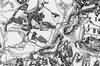 | Part of the 1 inch to 1 mile map of Sussex produced in 1825 by Christopher and John Greenwood | Crowboro | ||
| 1834 | History | Crowborough | Horsfield's Sussex | ||
| Crowborough is worthy of notice. It is remarkable for its great height, being the fourth highest hill in the county, and 804 feet above the level of the sea; on the summit stood formerly a beacon; in the bottom, at the south-east side, stands two neat edifices, exhibiting the appearance of a hermitage. They are a chapel and a school house funded by Sir Henry Fermor, Bart., late of Sevenoaks, Kent, whose family were originally of this parish. | |||||
| 1838 | Census | Crowborough | 1838 Census Crowborough Town, Sussex | ||
| That part of Withyham Parish known as Crowborough Town. | |||||
| 1838 | Census | Crowborough | 1838 Census Crowborough Warren and Lye Green, Sussex | ||
| That part of Withyham Parish known as Crowborough Warren, Lye Green and Friars Gate. | |||||
| 1840 | ![[North] Sussex](images/t/Dugdale1840E.jpg) | [North] Sussex by Joshua Archer, Pentonville, London | Crowborough | Dugdale | |
| Dugdale's England and Wales Delineated | |||||
| 6th Jun 1841 | Census | Crowborough | 1841 Census Rotherfield, Sussex | ||
| From the Boars Head Inn by the Turnpike Road leading to Tunbridge Wells to the Crown Corner then taking the boundary of the Parish on the East to the two cottages at the corner of Nap Wood, and from thence to Gravel Pit on Saxonbury Hill, taking the road past Green Hedges to Sprats Bottom, then by the Stream to Cowford Bridge, keeping up the road about eight roods then turn in the gate at the bottom of Hornshurst Wood past Turks taking the house, then over Johnsons Bridge along the bottom of Lime Kiln Forest taking Testers and Browns houses and come out at the Boars Head Inn. Enumerator - William Wickenden | |||||
| 6th Jun 1841 | Census | Crowborough | 1841 Census Rotherfield, Sussex | ||
| From the Boars Head Inn taking the North West side of the Turnpike Road to Crown Turning and from thence taking the boundary of the parish to the North, keeping the boundary round to Orznash then cross by Stone House taking that straight to Boars Head Inn. Enumerator - James Lockyer | |||||
| 6th Jun 1841 | Census | Crowborough | 1841 Census Rotherfield, Sussex | ||
| From Johnnsons Bridge to Maynards Gate by the stream, then to Henry Pains and Frogs Hole, by the Beeches to White Hart and Crowborough Cross Inns, to Cooks Corner taking all the North side and South of Orznash and Stone House straight across to the Boars Head Inn and from thence by the Lime Kiln Forest to Johnsons Bridge. Enumerator - D.T. Dadswell | |||||
| 6th Jun 1841 | Census | Crowborough | 1841 Census Rotherfield, Sussex | ||
| From Henry Pains to Jarvis Brook from thence to the cross ways at Coldharbour and from there on the road leading to Crowborough Cross as far as the turning called the Roundabout and back by the White Hart to Henry Pains. Enumerator - Thomas Crittall | |||||
| 6th Jun 1841 | Census | Crowborough | 1841 Census Rotherfield, Sussex | ||
| From Cold Harbour to the Sheep Plains, taking all on the North West to the boundary of the Parish on the Common, from the Sheep Plains to Cooks Corner then back to Crowborough Cross by the Roundabout to Cold Harbour. Enumerator - John Whitewood | |||||
| 6th Jun 1841 | Census | Crowborough | 1841 Census Rotherfield, Sussex | ||
| From Jarvis Brook by Sand Hill to Ford Brook on the road to the boundary of the Parish on Brick Barn Hill, then follow the boundary round to the Sheep Plains and back by the road to Cold Harbour and Jarvis Brook. Enumerator - Steven Wickens | |||||
| 6th Jun 1841 | Census | Crowborough | 1841 Census Withyham, Sussex | ||
| All that part of the parish of Withyham which lies between the road which leads from Withyham bridge to Penns Rocks and the stream which runs from Cooks Corner to the stream which runs from Croborough Mills and the fence which incloses Croborough Warren. The district being bounded on the East by the parish of Rotherfield and on the West by the parish of Hartfield Enumerator - Charles Hoare | |||||
| 6th Jun 1841 | Census | Crowborough | 1841 Census Withyham, Sussex | ||
| All that part of the parish of Withyham which lies to the north and northeast of the road leading from Withyham bridge to Penns Rocks including the house and estate of Penns Rocks Enumerator - Thomas Patching | |||||
| 6th Jun 1841 | Census | Crowborough | 1841 Census Withyham, Sussex | ||
| All that part of the parish of Withyham called Croborough and which lies to the south of the stream running from Cooks Corner to the Croborough Mills stream, the remainder of the boundary formed by the fence surrounding and including Crowborough Warren Enumerator - Thomas Cripps | |||||
| 1851 | Directory | Crowborough | Post Office Directory | ||
| ROTHERFIELD is a parish in Uckfield Union, 7 miles south-east from Tunbridge Wells, and 42 from London, giving name to a Hundred in Pevensey rape. Its area is 14,710 acres, and its population, in 1841, 3,054. It is assessed to the Income Tax at £9,224. .......... | |||||
| 30th Mar 1851 | Census | Crowborough | 1851 Census Rotherfield, Sussex | ||
| From the Boars Head Inn by the Turnpike Road leading to Tunbridge Wells to the Crown Corner then taking the boundary of the Parish on the East to the two cottages at the corner of Nap Wood, and from thence to Gravel Pit on Saxonbury Hill, taking the road past Green Hedges to Sprats Bottom, then by the Stream to Cowford Bridge, keeping up the road about eight roods then turn in the gate at the bottom of Hornshurst Wood past Turks taking the house, then over Johnsons Bridge along the bottom of Lime Kiln Forest taking Testers and Browns houses and come out at the Boars Head Inn. Enumerator - William Wickenden | |||||
| 30th Mar 1851 | Census | Crowborough | 1851 Census Rotherfield, Sussex | ||
| From the Boars Head Inn taking the North West side of the Turnpike Road to Crown Turning and from thence taking the boundary of the parish to the North, keeping the boundary round to Orznash then cross by Stone House (taking that) straight to Boars Head Inn. Enumerator - Henry Hickmott | |||||
| 30th Mar 1851 | Census | Crowborough | 1851 Census Rotherfield, Sussex | ||
| From Johnnsons Bridge to Maynards Gate by the stream, then to Henry Pains and Frogs Hole, by the Beeches to White Hart and Crowborough Cross Inns, to Cooks Corner taking all the North side and South of Orznash and Stone House straight across to the Boars Head Inn and from thence by the Lime Kiln Forest to Johnsons Bridge. Enumerator - D.T. Dadswell | |||||
| 30th Mar 1851 | Census | Crowborough | 1851 Census Rotherfield, Sussex | ||
| From Henry Pains to Jarvis Brook from thence to the cross ways at Coldharbour and from there on the road leading to Crowborough Cross as far as the turning called the Roundabout and back by the White Hart to Henry Pains. Enumerator - William Wickens | |||||
| 30th Mar 1851 | Census | Crowborough | 1851 Census Rotherfield, Sussex | ||
| From Cold Harbour to the Sheep Plains, taking all on the North West to the boundary of the Parish on the Common, from the Sheep Plains to Cooks Corner then back to Crowborough Cross by the Roundabout to Cold Harbour. Enumerator - James Lockyer | |||||
| 30th Mar 1851 | Census | Crowborough | 1851 Census Rotherfield, Sussex | ||
| From Jarvis Brook by Sand Hill to Ford Brook on the road to the boundary of the Parish on Brick Barn Hill, then follow the boundary round to the Sheep Plains and back by the road to Cold Harbour and Jarvis Brook. Enumerator - George Pilbeam | |||||
| 30th Mar 1851 | Census | Crowborough | 1851 Census Withyham, Sussex | ||
| All that part of the Parish of Withyham which is bounded on the West by the Parish of Hartfield and which lies on the South side of the road leading from Withyham to Pens Rocks and which is bounded on the South by that part of the parish called Crowborough and Crowborough Warren including the Hamlets, Rectory of Withyham, Buckhurst Park, Buckhurst Farm, Fishers Gate, part of the 500 Acres Wood, Friars Gate, Grubbs Farm, Fords Fields, Cooks Corner, Gillridge, Summersales, Lye Green and Plume of Feathers, etc. Enumerator - Thomas Rickard | |||||
| 30th Mar 1851 | Census | Crowborough | 1851 Census Withyham, Sussex | ||
| All that part of the Parish of Withyham which lies on the South side of the stream which runs from Cook's Corner to Friars Gate including the whole of Crowborough Warren, Crowborough Mills, St John's Chapel, Alms Houses and School, and all that part of the parish called Crowborough. Enumerator - Richard Martin, St Johns | |||||
| 30th Mar 1851 | Census | Crowborough | 1851 Census Buxted, Sussex | ||
| All that part of the Parish of Buxted lying North of 3c District to the extremity of the parish, including that part of Crowborough Warren that lies in the Parish of Buxted, Little Warren, Broom, Chillys Farm, Grovehurst and Hurst Wood. Enumerator - John Alchorne | |||||
| 1864 | 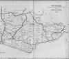 | East Sussex with the addition of the Railways by Mark Antony Lower | Crowborough | Lower's Sussex | |
| Mark Antony Lower, son of Richard Lower, born 14th July 1813 in Heathfield, school master in the early 1830s at East Hoathly, Heathfield and Alfriston; and at Lewes from 1835 to 1867; and at Seaford 1867-1871. He then moved to London where he died in 1876. He was a founder member of the Sussex Archeological Society and a prolific contributor to the collections of the society. He published
| |||||
| 1867 | Directory | Crowborough | Post Office Directory | ||
| ROTHERFIELD is a large parish, giving name to a hundred, in the Eastern division of the county, Uckfield union, diocese of Chichester, archdeaconry of Lewes, Tunbridge Wells county court district and Pevensey rape, 7 miles south from Tunbridge Wells, 4 west from Wadhurst station, and 30 from London. ............... The area is 14,733 acres, and the population in 1861 was 3,413. The charities are £28 per annum. ................. | |||||
| 1874 | Directory | Crowborough | Post Office Directory | ||
| Crowborough is a hamlet, 3 miles west, partly in this and partly in Withyham parish. There is a chapel of ease (St. John the Evangelist), with parsonage and school-house adjoining, both endowed in 1732 by Sir Henry Fermor. Almshouses for six aged persons (widows and widowers) were erected by the late Countess De La Warr. | |||||
| c 1875 |  | Part of the 6 inch to 1 mile map of Sussex produced in 1875 by Ordnance Survey | Crowborough | ||
| 3rd Apr 1881 | Census | Crowborough | 1881 Census Rotherfield, Sussex | ||
| North of Crowborough including Laurell Trees, Orznash, Bullfinches, Burchden, Cobbarn and Eridge | |||||
| 3rd Apr 1881 | Census | Crowborough | 1881 Census Rotherfield, Sussex | ||
| North East of Crowborough including Charity Farm, Crowborough Cross, Aln House, Luxford Farm, Cooks Corner and Pales Gate | |||||
| 3rd Apr 1881 | Census | Crowborough | 1881 Census Rotherfield, Sussex | ||
| South East of Crowborough including Chapel Green, Black Nest, Coldharbour, Jarvis Brook and Crowborough Station Railway Hotel | |||||
| 3rd Apr 1881 | Census | Crowborough | 1881 Census Rotherfield, Sussex | ||
| South West of Crowborough including Crowborough Cross Inn, Beacon Observatory, South View and Coldharbour | |||||
| 3rd Apr 1881 | Census | Crowborough | 1881 Census Rotherfield, Sussex | ||
| South of Crowborough including Hurtis Hill, Slaugham Gill, Stone Cross, Adams Farm, Alfris Farm, Sweethams, Welshes and Foordbrook Farm | |||||
| 3rd Apr 1881 | Census | Crowborough | 1881 Census Withyham, Sussex | ||
| South of Withyham including Lye Green, Friars Gate, Half Moon Inn, Crowboro Warren, Mardens Hill, Crowboro Town, Coopers Arms, St Johns Vicarage and Church, Cooks Corner, Two Chimneys Baptist Chapel, Hoadleys Farm, Adds Farm, Hole Farm, Gillridge Farm and Summersales | |||||
| 1882 | Directory | Crowborough | Kelly's Directory | ||
| Crowborough, which has a station on the Tunbridge Wells and Lewes line of the Brighton and South Coast railway, has lately been formed into a district parish, from the parishes of Rotherfield and Withyham .............. The Crowborough beacon is 803 feet high. The area is 4,000 acres; population in 1881 was 1,700. ............. | |||||
| 1885 | History | Crowborough | Prince's Crowborough | ||
| … it will be found, for the most part, that the delightful and extensive scenery, the open, airy, and vivifying atmosphere, abounding in ozone, together with a numerous retinue of natural attractions in the vicinity, all contribute to secure to the visitor that measure of health which generally follows the due co-operation of an active body with a cheerful and contented mind. | |||||
| 1886 |  | W. T. Pike's 1885-1886 Blue Book and Directory | Pike's Blue Book | ||
| 1890 | History | Crowborough | Firmin's Guide | ||
Crowborough is remarkable for its elevated position, for its extensive and beautiful scenery, and for the purity and invigorating properties of its air. The great altitude of the ridge upon which it is placed lifts it far above the surrounding country and gives it its value and excellence. In the old histories of Sussex it is stated to be the fourth highest point in the county, and to be 804 feet above the level of the sea. But on the Ordnance Survey map, dated 1881, it is marked as 796 feet, which we must therefore presume to be the accurate height. From several points on the Beacon Road near the Common, the sea at Eastbourne, over 20 miles away, is visible without the aid of a telescope when the atmosphere is favourable. It must be searched for at the end of the South Downs, on the left hand, or southeast. Looking south, the range of the South Down hills forms the boundary of the horizon. On the right, to the west, we look over Ashdown Forest in the direction of Hampshire; on the left, eastward past Ticehurst into Kent; north-ward, past Frant and Tunbridge Wells, part of Kent is seen; and in a northwesterly direction, past East Grinstead, part of Surrey is discernible. On a fine day from the Common may be seen Chanctonbury Ring, a clump of trees situated on a lofty hill near Steyning; and further to the right a hill in Hampshire may be seen when the atmosphere is clear. In the vast circuit which the Beacon Hill commands a large number of churches, and conspicuously the church tower of East Grinstead, are discernible. Also can be seen houses at Frant and the tower on Saxonbury Hill, which is about 60 feet in height. The Brightling Needle may occasionally be seen. This is an erection about 40 feet high, built by the late Mr. Fuller to assist him in his astronomical pursuits. | |||||
| 1890 | History | Crowborough | Firmin's Guide | ||
Nature has been very bountiful to Crowborough. Placed on one of the most elevated ridges in the county of Sussex, it commands extensive panoramic views, being surrounded by valleys and hills richly beautified in form and colour. What can be more exquisite than the picture exhibited from the point where the Beacon Hill Road meets the Common? The wide expanse of gorse, covered with its flower-mantle of golden hue; further on, the broad space of heather mingling with the citron tone of the grass; beyond this, cultivated fields vieing with the emerald in richness; the deep-toned greys of the woods on the gently sloping hills, with the rich browns of the ploughed earth; the almost sapphire tone of some of the distant hills, the blue and purple greys which enwrap the others, and between them a glimpse of the sea, like a field of silver up to the horizon, make a scene of beauty unsurpassed in the South of England. Can any eye behold this without conveying to the mind impressions which no language can adequately express, with-out stirring within it emotions of the deepest wonder and admiration at the beauty and sublimity of Nature's operations? If so, Nature has toiled in vain for such. The mind thus insensitive to the influence of objects delicately beautiful loses that exquisite pleasure which those experience who are keenly sensitive to every im-pression they convey. Grosser things are better adapted to such grosser sense. The open spaces about Crowborough are invaluable to the place, giving a freedom of rambling for miles over wild expanses covered with gorse and heather, now dipping into valleys, now over plateaus, then up a steep hill and across its broad back, offering a variety of charms, beguiling the pedestrian over miles, forgetful of fatigue and the speed of time. He is surrounded by charms of form and colour, while the sweet notes of sound fall softly on his ear, for the skylark, most joyous of British birds, hovers over the scene, and sings its cheering song, out of sight in ethereal heights, all the summer day long. The walks and drives are numerous, every route displaying differences of some kind of a pleasing and interesting character, a never-failing source of delight and enjoyment to every one who visits this charming locality. | |||||
| 1890 | History | Crowborough | Firmin's Guide | ||
The value of Crowborough as a health resort has hitherto been known to comparatively few healthseekers, yet nevertheless the demand for accommodation by those who have sought to avail themselves of its advantages in this respect has been greater than it was possible to supply. Many have gone away disappointed after a fruitless search for a habitation. The demand has, as usual in such cases, brought about the supply, and consequently the accommodation for visitors has considerably increased. There are evidences also of further preparations for the reception of a still larger number of persons. Many go to and fro about the world seeking the renovation of health, and travel hundreds of miles from home in pursuit of that which they might find nearer at hand. Let such, before again embarking on such peregrinations, give a trial to Crowborough, and test the restorative virtue of its salubrious air, and they will probably not again resort to the tedious and exhaustive expedient of a long voyage or journey to a spot where, after all, they may fail to find what they so earnestly seek after. The air is sweet and is often saturated with the perfume of the pine plantations which abound here, particularly on the Warren estate. The south wind brings with it a flavour of the sea, which is distant about 21 miles. The heather when in bloom also mingles its sweetness with the soft breezes which even on the hottest days float over the deep-toned common. It is also bracing and invigorating, comparing favourably with that of any seaside place. The visitor is astonished at its immediate effect in increasing the appetite and giving a greater power of exertion. He wonders at the increase of .his pedestrian powers and the enchantment which draws him on for miles, forgetful of time and distance, till he is awakened to the fact of his being a long way from home by the keenness and importunity of his appetite, a sensation to which probably he had been a stranger for a long time previously. | |||||
| 5th Apr 1891 | Census | Crowborough | 1891 Census Rotherfield, Sussex | ||
| Being that part commencing at Johnsons Bridge taking the stream to Maynards Gate and Frogshole to the Beeches and Crowborough Cross then to Cooks Corner and Orznash to Boarshead Inn and Johnsons bridge. Contents comprising the Cottages at Pales Gate, Steel Cross House, Poundfield, Charity Farm, Hourne, Steel Cross, Boars Head, Crowboro Cross and Houses on the old Turnpike Road The whole in the Parliamentary Division of Rye. | |||||
| 5th Apr 1891 | Census | Crowborough | 1891 Census Rotherfield, Sussex | ||
| Being that part commencing at Mr Brooker's Shop at Frogshole taking the Cottages to Jarvis Brook to the Crossways at Coldharbour keeping the North side of the Road to Crowboro Cross, then take the Road to the White Hart and Frogshole. Contents comprising the Railway Station, Hotel, Farningham Road, Towners Hill, Beeches, White Hart, Chapel Green, Roundabouts, Myrtle Road, Trenches Corner, Blacknest and Cock Mount Cottages The whole in the Parliamentary Division of Rye. | |||||
| 5th Apr 1891 | Census | Crowborough | 1891 Census Rotherfield, Sussex | ||
| Being that part commencing at Coldharbour keeping the Road to the Sheeplain and Cookscorner, Crowboro Cross and Coldharbour. Contents comprising Beacon Hill, The Observatory, Red Cross Inn, Wind mill House, Mr Mackintosh's, Mr Dents, South View and Crowboro Common The whole in the Parliamentary Division of Rye. | |||||
| 5th Apr 1891 | Census | Crowborough | 1891 Census Rotherfield, Sussex | ||
| Being that part commencing at Jarvis brook to Sand hill by Fordbrook to the Boundary of the Parish on Brick Barn Hill still keeping the Parish Boundary to the Sheepplain back to the Rose and Crown, Coldharbour and Jarvis Brook. Contents comprising Walshes, Burnt Oak, Brookhouse, Sweethaws, Slaugham Gill, Moses, Adams, Stone Cross, The Rocks, Highbroom, Redbridge and Fordbrook The whole in the Parliamentary Division of Rye. | |||||
| 5th Apr 1891 | Census | Crowborough | 1891 Census Withyham, Sussex | ||
| Boundary All that part of the Parish of Withyham which lies to the East and South East of the highway leading from Lye Green to Maresfield including all the houses from the entrance to Penns Rocks to Greenwood Gate on both sides of the road Contents this District includes the whole of the Ecclesiastical District of St. Johns Crowborough, Friars Gate, Lye Green, Park Grove, Gilridge, Home's Lodge, Park Cottages, and the Lodge at the top of the Five Hundred acres wood, Greenwood Gate, and all that part of Crowborough Warren which is in Withyham Parish, also all the houses right and left of the main road leading from Lye Green to Crowborough Cross The whole in the parliamentary division of East Grinstead | |||||
| c 1899 |  | Part of the 6 inch to 1 mile map of Sussex produced in 1899 by Ordnance Survey | Crowborough | ||
| 1903 | Reflections | Crowborough | Highways & Byways | ||
| In the spring of this year (1903) the walls and fences of Crowborough were covered with the placards of a firm of estate agents describing the neighbourhood (in the manner of the great George Robins) as 'Scotland in Sussex.' The simile may be true of the Ashdown Forest side of the Beacon (although involving an unnecessary confusion of terms), but 'Hampstead in Sussex' would be a more accurate description of Crowborough proper. | |||||
| 1904 | Reflections | Crowborough | Highways & Byways | ||
Between Withyham and Hartfield in the north, and Crowborough Beacon and Wytch Cross in the south, is some of the finest open country in Sussex, where one may walk for hours and meet no human creature. Here are silent desolate woods - the Five Hundred Acre Wood, under Crowborough, chief of them - and vast wastes of undulating heath, rising here and there to great heights crowned with fir trees, as at Gill's Lap. A few enclosed estates interrupt the forest's open freedom, but nothing can tame it. Sombre dark heather gives the prevailing note, but between Old Lodge and Pippinford Park I once came upon a green and luxuriant valley that would not have been out of place in Tyrol; while there is a field near Chuck Hatch where in April one may see more dancing daffodils than ever Wordsworth did. | |||||
| 6th Aug 1914 | Biographical note | Formed a Civilian National Reserve at Crowborough | Sir Arthur Ignatius Conan Doyle | Crowborough | Brian Pugh |
| 1928 |  | Borowe or Manor of Alchorne in 1560 by Mr Chapman and Catherine Pullein | Crowborough | Pullein's Rotherfield | |
The Weald is at Database version 14.05 which has ongoing updates to the 395,000 people; 9,000 places; 613 maps; 3,308 pictures, engravings and photographs; and 248 books loaded in the previous version


