
| Historical notes about Wadhurst |
| c 830 | History | Wadhurst | Wace's Wadhurst | ||
| " Wada " is a name of both place and person in old English. Hurst is Saxon for Wood." The Manor of Mellinges (Mailing) in which Wadhurst was included belonged to the Kings of Wessex, and was given by King Egbert and his son Ethelwolf, between 823 and 836, to the Church of Christ Church, Canterbury. | |||||
| 1086 | History | Wadhurst | Wace's Wadhurst | ||
| Wadhurst is not mentioned in Domesday there is in it an analysis of the value of the great Manor of Mellinges, stretching northwards from near Lewes to the Kent Boundary at Lamberhurst, which included both Wadhurst and Mayfield. …there is a table which illustrates in what lay the actual and potential wealth of the tract as the Norman then saw it. | |||||
| c 1180 | History | Wadhurst | Wace's Wadhurst | ||
| It is equally curious that the first mention of Wadhurst in documents of that time should have been found in the Register of another Abbey - Battle - which records that in the reign of Henry II. (1154-89) "Simon-de-Srimonte and his wife gave to the Abbey of Battel all his land in the Parish of Wadehurst which Henry, Chaplain of Wadehurst held of them." | |||||
| 1253 | History | Wadhurst | Wace's Wadhurst | ||
| Mediaeval records help in reconstructing a picture of the Church and its surroundings in former days. It was in the churchyard in the first place that fairs were generally held, and the slope on which the Church stands was probably in the Middle Ages covered every year by the booths and wares collected in fair-time under its shadow, by right of the grant made by Pope Boniface to, the Archbishop in 1253, for a weekly market on Saturday and a fair on the feast of SS. Peter and Paul, to whom the Church is dedicated. | |||||
| 1312 | History | Wadhurst | Wace's Wadhurst | ||
| Under Edward III there was war with Scotland and in 1312 commissions were given to array the County Forces, first up to five hundred, then to one thousand. The County History tells us that a commission for array of three hundred archers was given to Robert de Etchingham of Bibleham, and in the Wadhurst lists of that reign stands the name of J. de Wadehurst, who held part of a Knight's fee in Wadhurst and Church Settle, and was a " Bibleham Archer." | |||||
| 1328 | Tax list | Wadhurst | Bell-Irving | ||
| In 1328 Edward III levied a universal tax to pay for wars against the Scots and the list of the amounts paid by the Maghefeld [Mayfield] and Wadehurst [Wadhurst] landowners is still in existence. | |||||
| 1332 | Tax list | Wadhurst | Bell-Irving | ||
| In 1332 Edward III levied a universal tax to pay for wars against the Irish and the Scots and the list of the amounts paid by the Maghefeld [Mayfield] and Wadehurst [Wadhurst] landowners is still in existence. | |||||
| 1545 | History | Wadhurst | Wace's Wadhurst | ||
| … in the XVth Century the County figures in the rebellion of Jack Cade, aimed … against the King. A large contingent of Sussex men joined Cade's Kentish followers. When the rebels had been turned back, partly beaten, and partly demoralized by the desertions which followed an offer of pardon, among the four hundred Sussex men named in the pardon of 7th July were four or five Wadhurst men. Nor did they suffer for having "joined up," for their names appear again in taxation lists of 1545 for amounts creditable to the position they were then holding. | |||||
| 1610 | ![[North] Sussex](images/t/Speed1610E.jpg) | [North] Sussex by John Norden and augmented by John Speed | Wadehurst | John Speed | |
| The first engraved maps of the counties of Great Britain were the work of Christopher Saxton who, under the authority of the Privy Council, surveyed the English counties in Elizabethan times, from 1574 to 1578. In 1593 he was followed by John Norden who projected an ambitious scheme for a complete series of county histories. He published before his death a number of counties - Middlesex, Hertfordshire, Essex, Northampton, Cornwall, Sussex and Surrey. John Speed's map of Sussex is based upon Norden's map and was engraved by Jodocus Hondius. It occupies pages nine and ten of John Speed's Atlas entitled "The Theatre of the Empire of Great Britaine", is 20 1/4 inches by 15 1/4 inches in size and shows additionally an interesting plan of Chichester and a spirited representation of the Battle of Hastings. | |||||
| 1645 | ![[North] Sussex](images/t/Blaeu1645E.jpg) | [North] Sussex by Jan Blaeu | Wadehurst | Jan Blaeu | |
| 1685 | History | Wadhurst | Wace's Wadhurst | ||
| The Revocation of the Edict of Nantes (1685) made its mark in Wadhurst by the arrival of at least one French Protestant at Maplehurst. Connected with this, probably, there exists the original list of " moneys collected in the Parish" of Wadhurst for the relief of the Poor Palatines, 1688." The total, £1 11s. 1d., is made up of forty-eight contributions, and attached to the list is this note - "The above mentioned Palatines were terribly ravaged by the French in 1688, some thousands of the mixed peasantry were sent to America by the British Government and by the British people." | |||||
| 1695 | ![[North] Sussex](images/t/Morden1695E.jpg) | [North] Sussex by Robert Morden | Wadehurst | Robert Morden | |
| Robert Morden was a London bookseller from 1669 until his death in 1703. He specialised in the geographical field and was himself something of a cartographer and a publisher. Throughout the 17th and most of the 18th centuries, there was little distinction between the activity of book or print-selling and that of publishing: many booksellers were also printers or engravers. They undertook the sale of each others' work and often combined to meet the high cost of publishing a new map or reissue of an old atlas, even if the original plates were still available. This map was published in Brittania: a chorographical description of Great Britain and Ireland by William Camden. | |||||
| c 1724 | 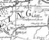 | Part of the 1 inch to 1 mile map of Sussex produced in 1724 by Richard Budgen | Wadhurst | ||
| 1745 | History | Wadhurst | Wace's Wadhurst | ||
| During the rising in Scotland in 1745 in favour of "The Pretender," Wadhurst and Ticehurst, like other places, had hot Jacobites and keen Hanoverians. The then Vicar of Wadhurst, Bush, always attributed much of the feeling shown against him in the matter of his tithes, to his having reported to Whiligh on the authority of a Ticehurst farmer that the Vicar of that place had preached a sermon in favour of the Pretender. | |||||
| 1750 | 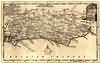 | Sussex by Thomas Kitchin | Wadhurst | Thomas Kitchin | |
| Thomas Kitchin, an engraver and publisher from c.1738 to 1776, held the appointment of Hydrographer to the King. His output was prolific. He engraved the maps of the British and French dominions in North America by John Mitchell (1755), which was used at the peace coucil at the end of the revolutionary war. In his later years he worked with his son (hence senior after his name in the c.1755 edition of the Small English Atlas). He died in 1784. | |||||
| 1763 | ![A New Map of [North] Sussex](images/t/Kitchin1763E.jpg) | A New Map of [North] Sussex by Thomas Kitchin | Wadhurst | Thomas Kitchin | |
| Thomas Kitchin, an engraver and publisher from c.1738 to 1776, held the appointment of Hydrographer to the King. His output was prolific. He engraved the maps of the British and French dominions in North America by John Mitchell (1755), which was used at the peace coucil at the end of the revolutionary war. In his later years he worked with his son (hence senior after his name in the c.1755 edition of the Small English Atlas). He died in 1784. | |||||
| 1st Sep 1787 | ![[North] Sussex](images/t/Cary1787E.jpg) | [North] Sussex by John Cary | Wadhurst | John Cary | |
| John Cary, apprenticed to William Palmer in 1770, went into business in 1783 as a publisher of maps, plans and road-books. He was highly successful and is referred to as the founder of the modern English School of Cartography by H.G. Fordham | |||||
| c 1795 |  | Part of the 1 inch to 1 mile map of Sussex produced in 1795 by William Gardner and Thomas Gream | Wadhurst | ||
| 1808 | ![[North] Sussex](images/t/Cole1808E.jpg) | [North] Sussex by G.Cole and engraved by J.Roper | Woodhurst | G. Cole | |
| The British atlas; comprising a series of county maps…intended to illustrate and accompany 'The beauties of England and Wales' published 1808. | |||||
| c 1825 |  | Part of the 1 inch to 1 mile map of Sussex produced in 1825 by Christopher and John Greenwood | Wadhurst | ||
| 1837 | ![[North] Sussex](images/t/Moule1837E.jpg) | [North] Sussex by Thomas Moule | Wadhurst | Thomas Moule | |
| Thomas Moule was a bookseller. He published a number of important works on heraldry and antiquities, including Bibliotheca heraldica Brittaniae in 1822. The English Counties delineated; or, a topographical description of England has a complete series of county maps and was published by Thomas Moule in 1837 | |||||
| 1840 | ![[North] Sussex](images/t/Dugdale1840E.jpg) | [North] Sussex by Joshua Archer, Pentonville, London | Wadhurst | Dugdale | |
| Dugdale's England and Wales Delineated | |||||
| 30th Mar 1851 | Census | Wadhurst | 1851 Census Wadhurst, Sussex | ||
| Town District comprises so much of the Parish as lies between the Upper Toll Gate and the cottages belonging to John Wallis near the Lower Toll Gate on both sides of the Road as is encompassed by a line. Enumerator - T. Barton | |||||
| 30th Mar 1851 | Census | Wadhurst | 1851 Census Wadhurst, Sussex | ||
| Shovers Green District. All that part of the Parish on the South side of the Turnpike Road from Stone Cross to Shovers Green, and on the West and North from Shovers Green by the boundary of the Parish to Coomb and on the East from Coomb to Stone Cross, including Church Settle, Crouches, Flattenden, Buttons, Hightown, Beales Oak, Wenbans, Scrag Oak etc. Enumerator - Thomas Piper | |||||
| 30th Mar 1851 | Census | Wadhurst | 1851 Census Wadhurst, Sussex | ||
| Bibleham District. All that part of the Parish on the North and West side of the Road from Stone Cross to Coomb and on the East and South from Tide Brook to Upper Toll Gate including Coomb, Chittinghurst, Reeds, part of Risenden, Windmill Farm, Foxes, Castle etc. Enumerator - William Reed | |||||
| 30th Mar 1851 | Census | Wadhurst | 1851 Census Wadhurst, Sussex | ||
| Risenden District. All that part of the Parish on the west and South side of the Road from Tide Brook to Best Beech Hill and on the East side of the Road from Best Beech Hill to Markcross including Markcross, Earls, Bassetts, Skinners, Buckhurst Wood, Town Gate, Tide Brook Mill, and part of Risenden etc. Enumerator - Henry Bull | |||||
| 30th Mar 1851 | Census | Wadhurst | 1851 Census Wadhurst, Sussex | ||
| Markcross and Riverhall District. All that part of the Parish on the West side of the road from Markcross to Little Durgate and on the South side of the Turnpike Road from Little Durgate to Riverhall, including Frankham, Great Buckhurst, Little Buckhurst, Beggars Bush, Ivy Chimney, Little Durgate, Faircrouch, Watergates, Riverhall etc. Enumerator - H T Austen | |||||
| 30th Mar 1851 | Census | Wadhurst | 1851 Census Wadhurst, Sussex | ||
| Cockmount District. Comprises all that part of the Parish on the North side of the Turnpike Road from the Upper Toll Gate to Riverhall and on the South and West side of the road from Great Shoesmiths to Sparrows Green, including Great Durgate, Greens, Dewhurst, Swatlands, Three Oaks, Newland Fields, Stonebridge, Cockmount and part of Sparrows Green etc. Enumerator - George Avery | |||||
| 30th Mar 1851 | Census | Wadhurst | 1851 Census Wadhurst, Sussex | ||
| Great Shoesmith District. Comprises all that part of the Parish on the North side of the road from Pitt House to Great Shoesmiths and on the South and West side of the road from Bartley Mill to Pitt House, including Great Shoesmiths, White Gates, Pook Pit, Bartley Mill, Stivers, Great Buckland Hill, Smiths, Perrins etc. Enumerator - William Walker | |||||
| 30th Mar 1851 | Census | Wadhurst | 1851 Census Wadhurst, Sussex | ||
| Pitt House District. Comprises all that part of the Parish on the East side of the road from Pitt House to Little Buckland Hill and on the North side from Wickhurst to White Magpie and on the West side of the Turnpike Road from Slade Gate to Pitt House including Wickhurst, Little Buckland Hill, Busses Green, White Magpie, part of Cousley Wood, Diproses, Gate House, part of Pell Green, Turners Green, Pitt House etc. Enumerator - Jacob Pitt | |||||
| 30th Mar 1851 | Census | Wadhurst | 1851 Census Wadhurst, Sussex | ||
| Cousley Wood District. Comprises all that part of the Parish on the East Side of the Turnpike Road from Slade Gate to Pell Green as far as Great Pell and from thence by a boundary line to Foxhole bottom including Markwicks, Lady Meads, Bewle Bridge Lane, Lower Cousley Wood, Sodom, Little Butts, part of Cousley Wood, Great Butts and part of Pell Green etc. Enumerator - Charles Brissenden | |||||
| 30th Mar 1851 | Census | Wadhurst | 1851 Census Wadhurst, Sussex | ||
| Pell Bridge District. All that part of the Parish on the East Side of the Turnpike Road from Pell Green to Sparrows Green and Upper Toll Gate and on the North side of the Town boundary to Stone Cross and on the North Side of the Turnpike road from Stone Cross to Shovers Green and on the South by a boundary line from Foxhole Bottom to Great Pell, including Newhouse, part of Sparrows Green, Pell Bridge, Vicarage Green, Great Pell, Little Pell, Moseham, Foxhole etc. Enumerator - Richard White | |||||
| 1864 | 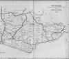 | East Sussex with the addition of the Railways by Mark Antony Lower | Wadhurst | Lower's Sussex | |
| Mark Antony Lower, son of Richard Lower, born 14th July 1813 in Heathfield, school master in the early 1830s at East Hoathly, Heathfield and Alfriston; and at Lewes from 1835 to 1867; and at Seaford 1867-1871. He then moved to London where he died in 1876. He was a founder member of the Sussex Archeological Society and a prolific contributor to the collections of the society. He published
| |||||
| 3rd Apr 1881 | Census | Wadhurst | 1881 Census Wadhurst, Sussex | ||
| Wadhurst Village, High Street and Church Street | |||||
| 3rd Apr 1881 | Census | Wadhurst | 1881 Census Wadhurst, Sussex | ||
| That part of Wadhurst Parish that includes Durgates, Rock Robins Hill and Sparrows Green | |||||
| 3rd Apr 1881 | Census | Wadhurst | 1881 Census Wadhurst, Sussex | ||
| That part of Wadhurst Parish that includes Turners Green and Woods Green | |||||
| 3rd Apr 1881 | Census | Wadhurst | 1881 Census Wadhurst, Sussex | ||
| That part of Wadhurst Parish that includes Cousley Wood, Pell Green, Balaclava Street and Busses Green | |||||
| 3rd Apr 1881 | Census | Wadhurst | 1881 Census Wadhurst, Sussex | ||
| That part of Wadhurst Parish that includes Pell Hill, Sparrows Green and Cousley Wood | |||||
| 3rd Apr 1881 | Census | Wadhurst | 1881 Census Wadhurst, Sussex | ||
| That part of Wadhurst Parish that includes Walland, Shovers Green, Wadhurst Park and Wadhurst Castle | |||||
| 3rd Apr 1881 | Census | Wadhurst | 1881 Census Wadhurst, Sussex | ||
| That part of Wadhurst Parish that includes Railway Station, Riverhall, Frankham and Faircrouch | |||||
| 3rd Apr 1881 | Census | Wadhurst | 1881 Census Wadhurst, Sussex | ||
| That part of Wadhurst Parish that includes Riseden and Wadhurst Park | |||||
| 3rd Apr 1881 | Census | Wadhurst | 1881 Census Wadhurst, Sussex | ||
| That part of Wadhurst Parish that includes Best Beech Hill and Tidebrook | |||||
| 17th Dec 1923 | History | Wadhurst | Wace's Wadhurst | ||
| IN MEMORIAM In the years 1914-18 a new and grievous experience came upon Wadhurst and all English villages. … The following is the Roll of Honour of the men whose lives were sacrificed in obedience to that call. Others offered themselves with similar devotion and served in the War. But these are the names of those whose devotion received the honour of death. Their sacrifice is recorded on two tablets below a Memorial Window in the Parish Church - a private gift - and on a conspicuous Cross at the entrance to the town; and all Wadhurst men, women and children, will henceforth be reminded, day by day, of the self-sacrifice by which alone their homes and their Country can be defended. | |||||
The Weald is at Database version 14.05 which has ongoing updates to the 395,000 people; 9,000 places; 613 maps; 3,308 pictures, engravings and photographs; and 248 books loaded in the previous version


