
| Historical notes about Withyham |
| 1095 | History | Withyham | Sutton's Historical Notes | ||
| A document about the year 1095 mentions Wideham thrice, states that Robert Count of Mortain had given it in fee farm to Robert the Monk of St Mary of Mortain, at £7 a year | |||||
| 1296 | History | Withyham | Sutton's Historical Notes | ||
| A subsidy roll of the reign of King Edward I contains the boroughs of Blackham and Birchden, which includes a large portion of the [Withyham] parish | |||||
| c 1300 | History | Withyham | Sutton's Historical Notes | ||
| The Manor of Withyham (called Mounkencourts or Munkloe) belonged in the 13th century to the Priory of Morteyn in Normandy. King Edward I in 1285, King Edward II in 1324 and King Edward III in 1337 all seized this Manor during wars with the French. The Manor was restored to the Priory of Morteyn in 1371. | |||||
| 1372 | History | Withyham | Sutton's Historical Notes | ||
| Withyham was a cell of the Abbey of St Martin, at Tours, in France | |||||
| 1412 | History | Withyham | Sutton's Historical Notes | ||
| Henry IV gave the Manor of Withyham called Mounkencourt, with the advowson of the Church of Withyham, and all lands, ... for twenty years … to the Prior and Convent of the Holy Trinity at Hastings | |||||
| 1590 to 1598 | History | Withyham | Sutton's Historical Notes | ||
| This [The Parish of Withyham] was an extensive manor. In a survey (32-40 Elizabeth) it includes the knoll by the church, extending from Withyham towards Summerford, between the road on the one side and the river on the other, to the Manor of Fiskeridge; afterwards by Hale Farm, Blackham Common (now enclosed), Willets Farm, bounded by the Kent Water; along by Holywych, the Sussex House Farm, Holtye Common, extending a little way into the Parish of East Grinstead on the right, over to the Beeches Farm and Bassetts, towards Hartfield and to Hodore. | |||||
| c 1597 |  | Part of the maps produced in 1597 in the Buckhurst Terrier | Withiham | ||
| 1597 to 1598 | History | Withyham | Buckhurst Terrier | ||
| Sir John Sackville, who was sheriff of Surrey and Sussex in the reign of Henry VIII, married Margaret Boleyn, the aunt of Queen Anne Boleyn, so that his son Richard was that queen's first cousin. This Richard Sackville was a man of outstanding ability.......He grew very rich by dealings in land in many counties, often the former possessions of suppressed chantrys and of attainted noblemen, his name appears more frequently in the Close Rolls of that period than that of any other person ............ It was jestingly said of him that his name should be Fillsack, not Sackville. He acquired the lands of the Chantry of St. Marie in 1550, those of the Fraternity of St. Katherine probably at about the same time, Tablehurst in 1559, Imberhorne in 1560, and Alchorne in 1564............... The manor of Broome, which included the greater part of the village of Hartfield, was purchased some time after 1584. Collinghurst was also in his possession at the time of his death, April 21, 1564. His only son Thomas, born in 1536, was one of the most prominent men of his time. In his earlier years a poet, he was a favourite of Elizabeth I, his second cousin.... On the 8th of June, 1567, he was knighted, and on the same day created a baron under the title of Lord Buckhurst. Alter many services to the State he was made Lord High Treasurer in May, 1599. .......Soon after succeeding to the estates at the death of his father he set about the acquisition by purchase and exchange of further manors in the vicinity of Buckhurst......The manor of Withyham, called Mounkencourts or Munkloe 1569-70; the manors of Sheffield and Tarring Peverell 1570; Ridgehill 1576; Bolebrook 1590; Lavertie 1591; Framfield in 1592; Blackham 1592; Birchden, 1595; and Bullockstown in 1585.....Sir Thomas Sackville, Lord Buckhurst, had thus in 1597 in his possession seventeen manors in north-east Sussex, including the manor of Buckhurst, as well as several others in the southern part of the rape. In view of the many recent acquisitions, and the number of leases that had been granted since 1592, it was expedient to record the seventeen in a Terrier in 1597-8 | |||||
| 1610 | ![[North] Sussex](images/t/Speed1610E.jpg) | [North] Sussex by John Norden and augmented by John Speed | Wythyham | John Speed | |
| The first engraved maps of the counties of Great Britain were the work of Christopher Saxton who, under the authority of the Privy Council, surveyed the English counties in Elizabethan times, from 1574 to 1578. In 1593 he was followed by John Norden who projected an ambitious scheme for a complete series of county histories. He published before his death a number of counties - Middlesex, Hertfordshire, Essex, Northampton, Cornwall, Sussex and Surrey. John Speed's map of Sussex is based upon Norden's map and was engraved by Jodocus Hondius. It occupies pages nine and ten of John Speed's Atlas entitled "The Theatre of the Empire of Great Britaine", is 20 1/4 inches by 15 1/4 inches in size and shows additionally an interesting plan of Chichester and a spirited representation of the Battle of Hastings. | |||||
| 1645 | ![[North] Sussex](images/t/Blaeu1645E.jpg) | [North] Sussex by Jan Blaeu | Wythyham | Jan Blaeu | |
| 1695 | ![[North] Sussex](images/t/Morden1695E.jpg) | [North] Sussex by Robert Morden | Wythyham | Robert Morden | |
| Robert Morden was a London bookseller from 1669 until his death in 1703. He specialised in the geographical field and was himself something of a cartographer and a publisher. Throughout the 17th and most of the 18th centuries, there was little distinction between the activity of book or print-selling and that of publishing: many booksellers were also printers or engravers. They undertook the sale of each others' work and often combined to meet the high cost of publishing a new map or reissue of an old atlas, even if the original plates were still available. This map was published in Brittania: a chorographical description of Great Britain and Ireland by William Camden. | |||||
| c 1724 | 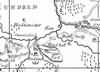 | Part of the 1 inch to 1 mile map of Sussex produced in 1724 by Richard Budgen | Withyham | ||
| 1750 | 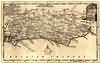 | Sussex by Thomas Kitchin | Withyham | Thomas Kitchin | |
| Thomas Kitchin, an engraver and publisher from c.1738 to 1776, held the appointment of Hydrographer to the King. His output was prolific. He engraved the maps of the British and French dominions in North America by John Mitchell (1755), which was used at the peace coucil at the end of the revolutionary war. In his later years he worked with his son (hence senior after his name in the c.1755 edition of the Small English Atlas). He died in 1784. | |||||
| 1756 | History | Withyham | Sutton's Historical Notes | ||
| The first school in Withyham …. Was kept by the Curate of the Parish, the Rev. Edward Boyce in the year 1756. The school house was one of the cottages on what is known as School House Hill, near Duckin's Farm. | |||||
| 1763 | ![A New Map of [North] Sussex](images/t/Kitchin1763E.jpg) | A New Map of [North] Sussex by Thomas Kitchin | Withyham | Thomas Kitchin | |
| Thomas Kitchin, an engraver and publisher from c.1738 to 1776, held the appointment of Hydrographer to the King. His output was prolific. He engraved the maps of the British and French dominions in North America by John Mitchell (1755), which was used at the peace coucil at the end of the revolutionary war. In his later years he worked with his son (hence senior after his name in the c.1755 edition of the Small English Atlas). He died in 1784. | |||||
| 1st Sep 1787 | ![[North] Sussex](images/t/Cary1787E.jpg) | [North] Sussex by John Cary | Withyham | John Cary | |
| John Cary, apprenticed to William Palmer in 1770, went into business in 1783 as a publisher of maps, plans and road-books. He was highly successful and is referred to as the founder of the modern English School of Cartography by H.G. Fordham | |||||
| c 1795 | 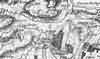 | Part of the 1 inch to 1 mile map of Sussex produced in 1795 by William Gardner and Thomas Gream | Withyham | ||
| 1808 | ![[North] Sussex](images/t/Cole1808E.jpg) | [North] Sussex by G.Cole and engraved by J.Roper | Wythyham | G. Cole | |
| The British atlas; comprising a series of county maps…intended to illustrate and accompany 'The beauties of England and Wales' published 1808. | |||||
| c 1825 | 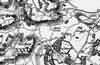 | Part of the 1 inch to 1 mile map of Sussex produced in 1825 by Christopher and John Greenwood | Withyham | ||
| 1837 | ![[North] Sussex](images/t/Moule1837E.jpg) | [North] Sussex by Thomas Moule | Wythyham | Thomas Moule | |
| Thomas Moule was a bookseller. He published a number of important works on heraldry and antiquities, including Bibliotheca heraldica Brittaniae in 1822. The English Counties delineated; or, a topographical description of England has a complete series of county maps and was published by Thomas Moule in 1837 | |||||
| 1838 | Census | Withyham | 1838 Census Withyham, Sussex | ||
| That part of Withyham Parish, South of the River Medway, known as Withyham Village, Buckhurst, and Balls Green. | |||||
| 1840 | ![[North] Sussex](images/t/Dugdale1840E.jpg) | [North] Sussex by Joshua Archer, Pentonville, London | Withyham | Dugdale | |
| Dugdale's England and Wales Delineated | |||||
| 6th Jun 1841 | Census | Withyham | 1841 Census Withyham, Sussex | ||
| All that part of Withyham which lies on the North side of the River Medway Enumerator - John Henry Farmer | |||||
| 6th Jun 1841 | Census | Withyham | 1841 Census Withyham, Sussex | ||
| All that part of the parish of Withyham which lies between the road which leads from Withyham bridge to Penns Rocks and the stream which runs from Cooks Corner to the stream which runs from Croborough Mills and the fence which incloses Croborough Warren. The district being bounded on the East by the parish of Rotherfield and on the West by the parish of Hartfield Enumerator - Charles Hoare | |||||
| 6th Jun 1841 | Census | Withyham | 1841 Census Withyham, Sussex | ||
| All that part of the parish of Withyham which lies to the north and northeast of the road leading from Withyham bridge to Penns Rocks including the house and estate of Penns Rocks Enumerator - Thomas Patching | |||||
| 6th Jun 1841 | Census | Withyham | 1841 Census Withyham, Sussex | ||
| All that part of the parish of Withyham called Croborough and which lies to the south of the stream running from Cooks Corner to the Croborough Mills stream, the remainder of the boundary formed by the fence surrounding and including Crowborough Warren Enumerator - Thomas Cripps | |||||
| 1851 | Directory | Withyham | Post Office Directory | ||
| WITHYHAM, or Withyam, is a parish in Hartfield Hundred, East Grinstead Union, Pevensey rape, with 9,080 acres, and a population of 1,692, assessed at £5,832. ………. | |||||
| 30th Mar 1851 | Census | Withyham | 1851 Census Withyham, Sussex | ||
| All that part of the Parish of Withyham which is on the North side of the River Medway including Summerford Farm, Hale Farm, Lye Wood Common, Highfields Park, Tophill, Lodgefield and Blackham. Enumerator - Thomas Avis | |||||
| 30th Mar 1851 | Census | Withyham | 1851 Census Withyham, Sussex | ||
| All that part of the Parish of Withyham which is on the South side of the River Medway and on the North side of the road which leads from Withyham Bridge to Pens Rocks, including Balls Green, Duckings, Ham, Hunts and Hendal Farms, Florence, Coarselys, Groombridge Gate, Birch Den, Motts Mill and Pens Rocks. Enumerator - John Avis | |||||
| 30th Mar 1851 | Census | Withyham | 1851 Census Withyham, Sussex | ||
| All that part of the Parish of Withyham which is bounded on the West by the Parish of Hartfield and which lies on the South side of the road leading from Withyham to Pens Rocks and which is bounded on the South by that part of the parish called Crowborough and Crowborough Warren including the Hamlets, Rectory of Withyham, Buckhurst Park, Buckhurst Farm, Fishers Gate, part of the 500 Acres Wood, Friars Gate, Grubbs Farm, Fords Fields, Cooks Corner, Gillridge, Summersales, Lye Green and Plume of Feathers, etc. Enumerator - Thomas Rickard | |||||
| 30th Mar 1851 | Census | Withyham | 1851 Census Withyham, Sussex | ||
| All that part of the Parish of Withyham which lies on the South side of the stream which runs from Cook's Corner to Friars Gate including the whole of Crowborough Warren, Crowborough Mills, St John's Chapel, Alms Houses and School, and all that part of the parish called Crowborough. Enumerator - Richard Martin, St Johns | |||||
| 1864 | 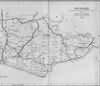 | East Sussex with the addition of the Railways by Mark Antony Lower | Withyham | Lower's Sussex | |
| Mark Antony Lower, son of Richard Lower, born 14th July 1813 in Heathfield, school master in the early 1830s at East Hoathly, Heathfield and Alfriston; and at Lewes from 1835 to 1867; and at Seaford 1867-1871. He then moved to London where he died in 1876. He was a founder member of the Sussex Archeological Society and a prolific contributor to the collections of the society. He published
| |||||
| 1867 | Directory | Withyham | Post Office Directory | ||
| WITHYHAM (or WITHIAM) is a parish, 8 miles south-cast from East Grinstead, and 7 south-west from Tunbridge Wells, in the Eastern division of the county, Hartfield hundred, East Grinstead union and county court district, Pevensey rape, Chichester diocese, and Lewes archdeaconry. .............. The area of the parish is 8,086 acres, and the population in 1861 was 1,597. .............. | |||||
| 1874 | Directory | Withyham | Post Office Directory | ||
| WITHYHAM (or WITHIAM) is a parish and station on the railway from East Grinstead to Tunbridge Wells, 8 miles south-east from East Grinstead, and 7 south-west from Tunbridge Wells, in the Eastern division of the county, Hartfield hundred, East Grinstead union and county court district, Pevensey rape, Chichester diocese, and Lewes archdeaconry. ............. The area of the parish is 8,086 acres; gross estimated rental, £10,825 ; rateable value, £9,934 ; and the population in 1871 was 1,970. ................... | |||||
| c 1875 | 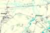 | Part of the 6 inch to 1 mile map of Sussex produced in 1875 by Ordnance Survey | Withyham | ||
| 3rd Apr 1881 | Census | Withyham | 1881 Census Withyham, Sussex | ||
| Withyham Village including Buckhurst Park, Duckings, Dorset Arms Inn, Balls Green, Beech Park, Highfields Park, Blackham and Lyewood Common | |||||
| 3rd Apr 1881 | Census | Withyham | 1881 Census Withyham, Sussex | ||
| North East of Withyham including Groombridge, Glenandred, Leywoods, Motts Mill, Penns Rocks, Sherlocks Farm, Alksford Farm, Hendal Farm and Hunts Farm | |||||
| 3rd Apr 1881 | Census | Withyham | 1881 Census Withyham, Sussex | ||
| South of Withyham including Lye Green, Friars Gate, Half Moon Inn, Crowboro Warren, Mardens Hill, Crowboro Town, Coopers Arms, St Johns Vicarage and Church, Cooks Corner, Two Chimneys Baptist Chapel, Hoadleys Farm, Adds Farm, Hole Farm, Gillridge Farm and Summersales | |||||
| 1882 | Directory | Withyham | Kelly's Directory | ||
| WITHYHAM (or WITHIAM) is a parish and station on the railway from East Grinstead to Tunbridge Wells, 8 miles south-east from East Grinstead and 7 south-west from Tunbridge Wells, in the Eastern division of the county, Hartfield hundred, East Grinstead union and county court district, Pevensey rape and rural deanery of Pevensey fourth division, Chichester diocese and Lewes archdeaconry. ........... TThe area is 8,086 acres; gross estimated rental £11,601; rateable value, £10,196 ; and the population in 1871 was 1,970 and in 1881, 2,150. .............. | |||||
| 1890 | History | Withyham | Firmin's Guide | ||
Withyham is about three and a half miles from Crowborough. There are two routes to it - one through Crowborough town over the Common and past Marden's Hill, the other by the Lye Green Road. This latter is perhaps the best for vehicles; along both routes the scenery is extensive and beautiful. The church, St. Michael and All Angels, is a fine massive old building, very picturesquely situated on rising ground, with ancient gravestones, rich with mosses and weather-stains, nestled around it. It is the very ideal of a country church and churchyard. Part of it was destroyed by lightning, and rebuilt in 1672. There are some monuments of interest in the Dorset Chapel by Flaxman and Nollekens. The altar-tomb of white marble, in the centre of the floor, immediately arrests our attention. The recumbent youthful figure represents the son of Richard Earl of Dorset, and the figures kneeling on either side his parents, the Earl and Countess. There are a few brasses on the walls, but there is no monument to perhaps the most illustrious of the Sackvilles, Thomas Lord Buckhurst, High-Treasurer to Queen Elizabeth, and the first Earl Dorset, a poet as well as a statesman, and joint-author of the first English Tragedy There are a few old timbered houses in the village, and the inn, the Dorset Arms, is quite in keeping with the associations and romance of the place. Neither is it without traditions of royalty. King Edward II attested a deed at Withyham, which is still preserved and was lately among the records in the Tower of London. This deed commanded proceedings against some foresters to be "stopt." | |||||
| 5th Apr 1891 | Census | Withyham | 1891 Census Withyham, Sussex | ||
| Boundary All that part of the parish of Withyham which lies on the North side of the highway leading from Withyham Village to Ham Farm including Ham Farm House Contents This district includes Blackham, Willietts Farm, Snails Gate, Highfield Park, Beech Park, Lyewood Common, The Railway Station, Balls Green, also the village of Withyham, Duckens Farm, Old Buckhurst, The Rectory House and Cottages, Fishers Gate and Cottages, The Keepers and other Cottages in the Five Hundred with the exception of the lodge at the Top, and all that part of Withyham Parish which is included in Buckhurst Park with the exception of the Lodgegate Cottage occupied by Wm. Holmes Park Keeper and the house and cottages opposite Lye Green The whole in the parliamentary division of East Grinstead | |||||
| 5th Apr 1891 | Census | Withyham | 1891 Census Withyham, Sussex | ||
| Boundary All that part of the Parish of Withyham which lies to the East of the Highway leading fron the top of School House Hill to Groombridge, on the South by the main road leading from School House Hill to Penns Rocks, and which is bounded on the East by the Parish of Rotherfield from Penns Rocks to Groombridge. Contents This district includes Hunts Farm, Holdings, Hendall Farm, Tatling Farm, Florence House, and all that part of Groombridge which is called the New Town, including the Railway Station, also all the houses on both sides of the main road leading from Groombridge to the entrance gate to Penns Rocks including Motts Mill Hamlet, Shelocks Farm, Leyswood, Penns Rocks House and Farm, and Glen Andred. The whole in the parliamentary division of East Grinstead | |||||
| 5th Apr 1891 | Census | Withyham | 1891 Census Withyham, Sussex | ||
| Boundary All that part of the Parish of Withyham which lies to the East and South East of the highway leading from Lye Green to Maresfield including all the houses from the entrance to Penns Rocks to Greenwood Gate on both sides of the road Contents this District includes the whole of the Ecclesiastical District of St. Johns Crowborough, Friars Gate, Lye Green, Park Grove, Gilridge, Home's Lodge, Park Cottages, and the Lodge at the top of the Five Hundred acres wood, Greenwood Gate, and all that part of Crowborough Warren which is in Withyham Parish, also all the houses right and left of the main road leading from Lye Green to Crowborough Cross The whole in the parliamentary division of East Grinstead | |||||
| 1904 | Reflections | Withyham | Highways & Byways | ||
Between Withyham and Hartfield in the north, and Crowborough Beacon and Wytch Cross in the south, is some of the finest open country in Sussex, where one may walk for hours and meet no human creature. Here are silent desolate woods - the Five Hundred Acre Wood, under Crowborough, chief of them - and vast wastes of undulating heath, rising here and there to great heights crowned with fir trees, as at Gill's Lap. A few enclosed estates interrupt the forest's open freedom, but nothing can tame it. Sombre dark heather gives the prevailing note, but between Old Lodge and Pippinford Park I once came upon a green and luxuriant valley that would not have been out of place in Tyrol; while there is a field near Chuck Hatch where in April one may see more dancing daffodils than ever Wordsworth did. | |||||
The Weald is at Database version 14.05 which has ongoing updates to the 395,000 people; 9,000 places; 613 maps; 3,308 pictures, engravings and photographs; and 248 books loaded in the previous version


